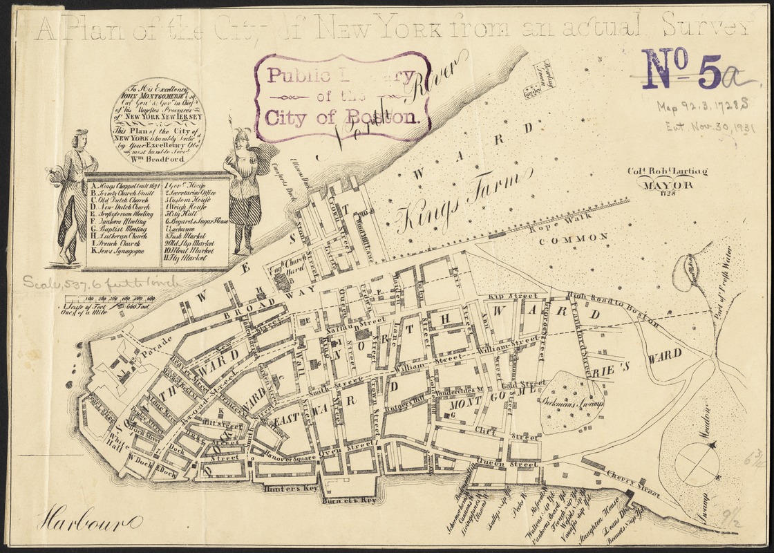
A plan of the city of New York from an actual survey
Item Information
- Title:
- A plan of the city of New York from an actual survey
- Commonly known as :
- Bradford plan
- Date:
-
[1860?–1869?]
- Format:
-
Maps/Atlases
- Location:
-
Boston Public Library
Norman B. Leventhal Map Center - Collection (local):
-
Norman B. Leventhal Map Center Collection
- Subjects:
-
Manhattan (New York, N.Y.)--Maps
- Places:
-
New YorkManhattan
- Extent:
- 1 map ; 18 x 25 cm.
- Terms of Use:
-
No known copyright restrictions.
No known restrictions on use.
- Publisher:
-
S.l :
s.n.
- Scale:
-
Scale [ca. 1:7,300]
- Language:
-
English
- Notes:
-
Drawn after the Bradford map (Cohen & Augustyn. Manhattan in maps, p. 54-56). Dedication cartouche is simplified and the mayor's name is printed without the seal.
Shows wards, streets, and public buildings.
Oriented with north to the upper right.
Includes references to points of interest.
- Identifier:
-
06_01_010768
- Call #:
-
G3804.N4:2M3 1730 .L96 1860
- Barcode:
-
39999065677096


