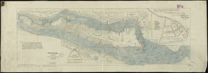
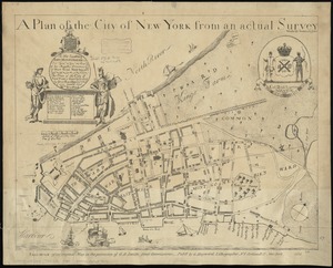
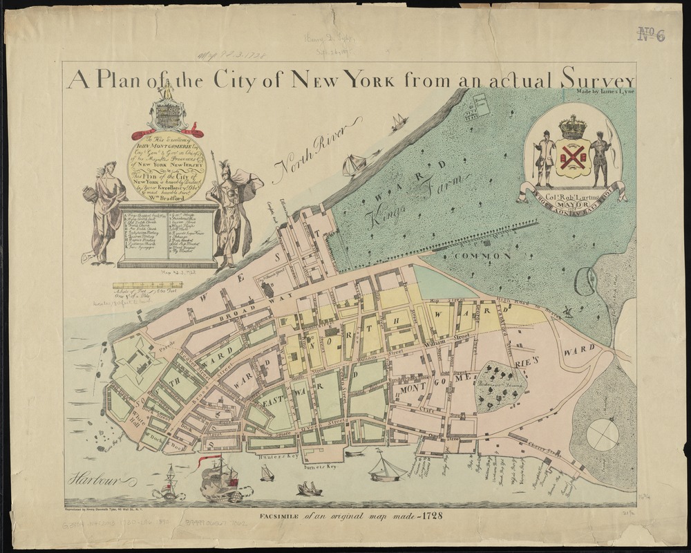
A plan of the city of New York from an actual survey
Item Information
- Title:
- A plan of the city of New York from an actual survey
- Commonly known as :
- Bradford plan
- Creator:
- Lyne, James.
- Name on Item:
-
made by James Lyne.
- Date:
-
[1890?]
- Format:
-
Maps/Atlases
- Location:
-
Boston Public Library
Norman B. Leventhal Map Center - Collection (local):
-
Norman B. Leventhal Map Center Collection
- Subjects:
-
Manhattan (New York, N.Y.)--Maps--Early works to 1800--Facsimiles
- Places:
-
New YorkManhattan
- Extent:
- 1 map : col. ; 42 x 54 cm.
- Terms of Use:
-
No known copyright restrictions.
No known restrictions on use.
- Publisher:
-
New York :
Reproduced by Henry Dunreath Tyler
- Scale:
-
Scale [ca. 1:3,200]
- Language:
-
English
- Notes:
-
Facsimile of the map published by William Bradford ca. 1731, showing the city ca. 1730.
Shows wards, streets, and public buildings.
Oriented with north to the upper right.
Includes references to points of interest.
Cartouche: To his excellency John Montgomerie, Esq. Capt. Genl. & Gov. in Chief of his Majestis provinces of New York New Jersey this plan of the city of New York is humbly dedic'd by Your Excellancy's obet & most humble servt, Wm. Bradford.
Seal at upper right: Col. Robt. Lurting, Mayor. 1728.
In lower margin: Facsimile of an original map made - 1728.
- Identifier:
-
06_01_010766
- Call #:
-
G3804.N4:2M3 1730 .L96 1890
- Barcode:
-
39999065677062