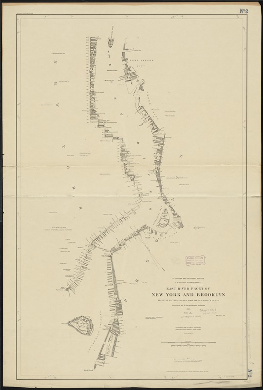
East River front of New York and Brooklyn from the Battery and Red Hook to Blackwell's Island
Item Information
- Title:
- East River front of New York and Brooklyn from the Battery and Red Hook to Blackwell's Island
- Creator:
- U.S. Coast and Geodetic Survey
- Name on Item:
-
surveyed by E. Hergesheimer Assistant ; topography inked by E. Hergesheimer ; lettering by E.H. Fowler ; J.H. Gray, aid.
- Date:
-
1886
- Format:
-
Maps/Atlases
- Location:
-
Boston Public Library
Norman B. Leventhal Map Center - Collection (local):
-
Norman B. Leventhal Map Center Collection
- Subjects:
-
East River (N.Y.)--Maps
- Places:
-
New York
East River
- Extent:
- 1 map ; 105 x 66 cm.
- Terms of Use:
-
No known copyright restrictions.
No known restrictions on use.
- Publisher:
-
[Washington] :
U.S. Coast & Geodetic Survey
- Edition:
- Issued Feb. 1886.
- Scale:
-
Scale 1:10,000
- Language:
-
English
- Notes:
-
Oriented with north toward upper left corner.
Shows streets, buildings and docks along the waterfront areas only.
"Reproduction by photo lithograph of original plane table sheet No. 1586."
- Identifier:
-
06_01_010728
- Call #:
-
G3802.E35 1886 .U83
- Barcode:
-
39999065676163


