Map of the city of Rochester
Item Information
- Title:
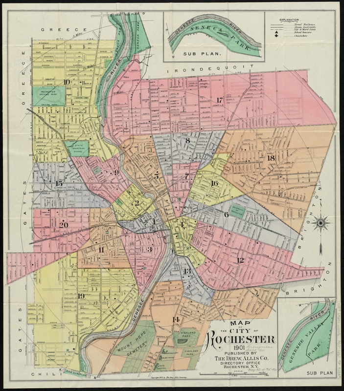
- Map of the city of Rochester
- Creator:
- Drew, Allis & Co
- Date:
-
1901
- Format:
-
Maps/Atlases
- Location:
-
Boston Public Library
Norman B. Leventhal Map Center - Collection (local):
-
Norman B. Leventhal Map Center Collection
- Subjects:
-
Rochester (N.Y.)--Maps
Rochester (N.Y.)--Administrative and political divisions--Maps
- Places:
-
Monroe (county)Rochester
- Extent:
- 1 map : col. ; 62 x 56 cm.
- Terms of Use:
-
No known copyright restrictions.
No known restrictions on use.
- Publisher:
-
Rochester, N.Y :
Drew, Allis Co.
- Scale:
-
Scale [ca. 1:14,250]
- Language:
-
English
- Notes:
-
Shows ward boundaries.
Insets: Sub plan [Seneca Park] -- Sub plan [Genesee Valley Park].
- Identifier:
-
06_01_010714
- Call #:
-
G3804.R6 1901 .D74
- Barcode:
-
39999065676304


