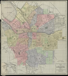
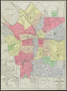
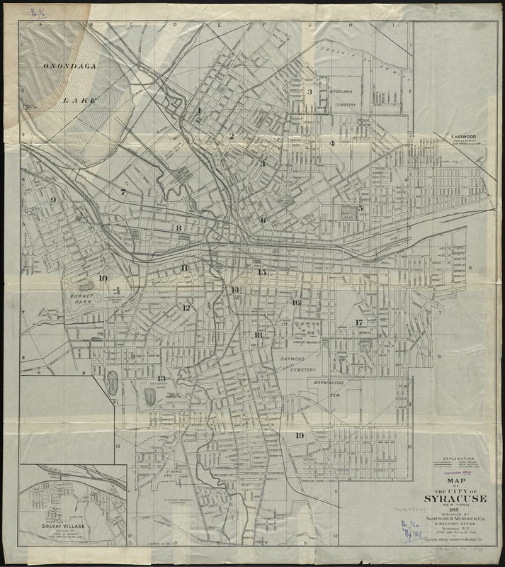
Map of the City of Syracuse, New York
Item Information
- Title:
- Map of the City of Syracuse, New York
- Creator:
- Sampson, Murdock & Co
- Date:
-
1915
- Format:
-
Maps/Atlases
- Location:
-
Boston Public Library
Norman B. Leventhal Map Center - Collection (local):
-
Norman B. Leventhal Map Center Collection
- Subjects:
-
Syracuse (N.Y.)--Maps
Syracuse (N.Y.)--Administrative and political divisions--Maps
Solvay (N.Y.)--Maps
- Places:
-
Onondaga (county)Syracuse
Onondaga (county)Solvay
- Extent:
- 1 map ; 79 x 71 cm.
- Terms of Use:
-
No known copyright restrictions.
No known restrictions on use.
- Publisher:
-
Syracuse, N.Y :
Sampson & Murdock Co.
- Scale:
-
Scale [ca. 1:12,000]. 1000 feet to the inch
- Language:
-
English
- Notes:
-
Shows streets, railroads, wards, and radial distances from city hall.
Insets: Eastwood (Town of De Witt) -- Solvay Village (Town of Geddes).
Inset of Eastwood not filled in.
- Identifier:
-
06_01_010712
- Call #:
-
G3804.S9 1915 .S36
- Barcode:
-
39999065676288