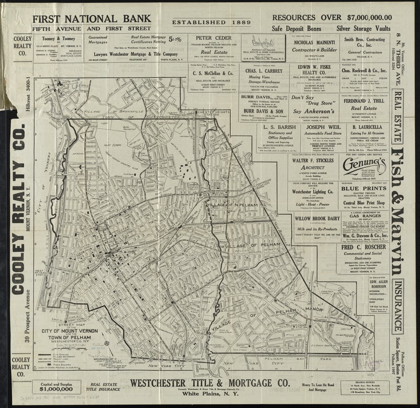
Street map of the city of Mount Vernon and the town of Pelham, Westchester County, N.Y
Item Information
- Title:
- Street map of the city of Mount Vernon and the town of Pelham, Westchester County, N.Y
- Creator:
- Fairchild, John F.
- Name on Item:
-
John F. Fairchild, C.E.
- Date:
-
[ca. 1921]
- Format:
-
Maps/Atlases
- Location:
-
Boston Public Library
Norman B. Leventhal Map Center - Collection (local):
-
Norman B. Leventhal Map Center Collection
- Subjects:
-
Railroads--New York (State)--Mount Vernon (Westchester County)--Maps
Railroads--New York (State)--Pelham (Town)--Maps
Street-railroads--New York (State)--Mount Vernon (Westchester County)--Maps
Street-railroads--New York (State)--Pelham (Town)--Maps
Mount Vernon (Westchester County, N.Y.)--Maps
Pelham (N.Y. : Town)--Maps
Mount Vernon (Westchester County, N.Y.)--Administrative and political divisions--Maps
- Places:
-
Westchester (county)Mount Vernon
Westchester (county)Pelham
- Extent:
- 1 map ; 54 x 61 cm., folded in cover 19 x 11 cm.
- Terms of Use:
-
No known copyright restrictions.
No known restrictions on use.
- Publisher:
-
Mount Vernon, N.Y :
John F. Fairchild
- Edition:
- 4th ed.
- Scale:
-
Scale [ca. 1:10,400]
- Language:
-
English
- Notes:
-
Shows district boundaries, trolley lines, railroads, and prominent buildings.
Oriented with north towards the upper left.
Includes advertisements.
Indexes and advertisements on verso.
Edition statement from cover.
- Identifier:
-
06_01_010707
- Call #:
-
G3804.M8 1921 .F35
- Barcode:
-
39999065676239


