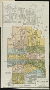
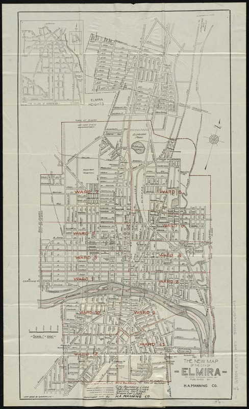
The new map of the City of Elmira
Item Information
- Title:
- The new map of the City of Elmira
- Title (alt.):
-
H.A. Manning Co's map of Elmira, New York
Map of Elmira, New York
- Creator:
- Wipfler, M. W.
- Name on Item:
-
map made by M.W. Wipfler.
- Date:
-
[ca. 1919]
- Format:
-
Maps/Atlases
- Location:
-
Boston Public Library
Norman B. Leventhal Map Center - Collection (local):
-
Norman B. Leventhal Map Center Collection
- Subjects:
-
Elmira (N.Y.)--Maps
Elmira (N.Y.)--Administrative and political divisions--Maps
Elmira Heights (N.Y.)--Maps
Horseheads (N.Y.)--Maps
- Places:
-
Chemung (county)Elmira
Chemung (county)Elmira Heights
Chemung (county)Horseheads
- Extent:
- 1 map : col. ; 69 x 38 cm., folded in cover 16 x 10 cm.
- Terms of Use:
-
No known copyright restrictions.
No known restrictions on use.
- Publisher:
-
[Elmira] :
H.A. Manning Co.
- Scale:
-
Scale [1:12,000]. 1ʺ = 1000ʹ
- Language:
-
English
- Notes:
-
Shows streets and ward boundaries.
Oriented with north to the upper right.
Inset: The Village of Horseheads.
- Identifier:
-
06_01_010689
- Call #:
-
G3804.E7 1919 .W571
- Barcode:
-
39999065676643