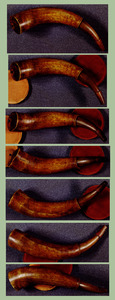
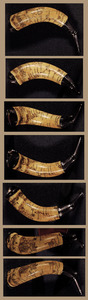
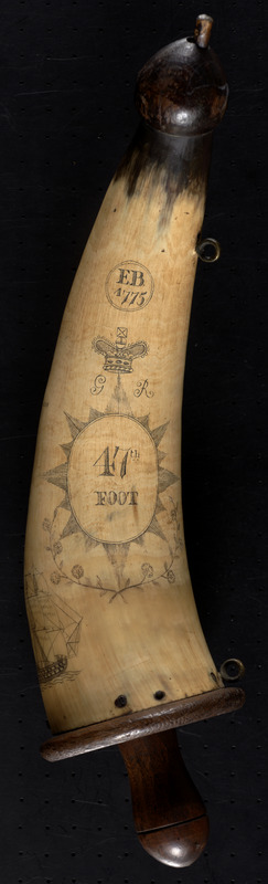
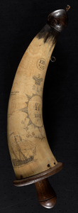
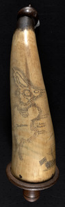
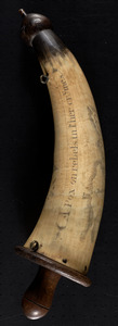
Powder horn with map of Boston and Charlestown, 1777

This map is also available in American Revolutionary Geographies Online (ARGO), a collections portal especially built for material relating to the American Revolutionary War Era. Visit ARGO to learn more about this item and explore the historical geography of North America in the late eighteenth century.
Item Information
- Title:
- Powder horn with map of Boston and Charlestown, 1777
- Cartographer:
- B., E.
- Name on Item:
-
E.B.
- Date:
-
1775
- Format:
-
Objects/Artifacts
Maps/Atlases
Manuscripts
- Location:
-
Boston Public Library
Norman B. Leventhal Map Center - Collection (local):
-
Norman B. Leventhal Map Center Collection
- Subjects:
-
Powder flasks--Early works to 1800
Boston (Mass.)--History--Revolution, 1775-1783--Maps, Manuscript--Early works to 1800
Charlestown (Boston, Mass.)--History--18th century--Maps, Manuscript--Early works to 1800
- Places:
-
Suffolk (county)BostonCharlestown
- Extent:
- 1 powder horn : manuscript, horn, wood, metal ; 36 x 9 cm
- Terms of Use:
-
No known copyright restrictions.
No known restrictions on use.
- Scale:
-
Not drawn to scale
- Language:
-
English
- Notes:
-
Powderhorn dating to 1775, featuring a map of Boston and Charlestown, Mass., noting Bunker Hill, Breed's Hill, Morton's Point, Mill Pond, Fox Hill, South Battery, Long Wharf and Hancocks wharf.
Includes engraving of a British Man-o-war ship, an armorial shield for the 47th Foot, the abbreviation "G R", floral decoration, and "A pox on rebels in ther crymes."
- Identifier:
-
06_01_010512
- Call #:
-
G3764.B6 1775 .B4x
- Barcode:
-
39999059010031