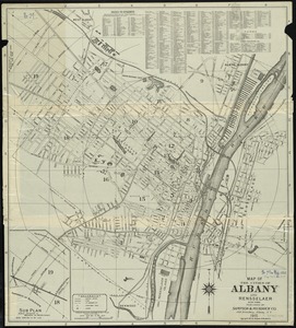
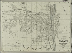
Map of the cities of Albany and Rensselaer and portions of Bath and East Greenbrush, New York
Item Information
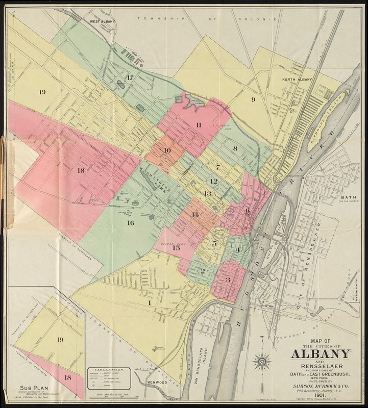
- Title:
- Map of the cities of Albany and Rensselaer and portions of Bath and East Greenbrush, New York
- Title (alt.):
-
New colored map of Albany
- Creator:
- Sampson, Murdock & Co
- Date:
-
1901
- Format:
-
Maps/Atlases
- Location:
-
Boston Public Library
Norman B. Leventhal Map Center - Collection (local):
-
Norman B. Leventhal Map Center Collection
- Subjects:
-
Albany (N.Y.)--Maps
Rensselaer (N.Y.)--Maps
- Places:
-
Albany (county)Albany
Rensselaer (county)Rensselaer
- Extent:
- 1 map : col. ; 63 x 58 cm., folded in cover 17 x 11 cm.
- Terms of Use:
-
No known copyright restrictions.
No known restrictions on use.
- Publisher:
-
Albany, N.Y :
Sampson & Murdock Co.
- Scale:
-
Scale [1:12,000]. 1000 ft. to the in.
- Language:
-
English
- Notes:
-
Shows drainage, streets, railroads, and certain structures.
Inset: Sub plan showing continuation of Washington and Western Avenues.
- Identifier:
-
06_01_010626
- Call #:
-
G3804.A3 1901 .S36
- Barcode:
-
39999065675181