Gentlemen's driving map showing the park system of Boston
Item Information
- Title:
- Gentlemen's driving map showing the park system of Boston
- Description:
-
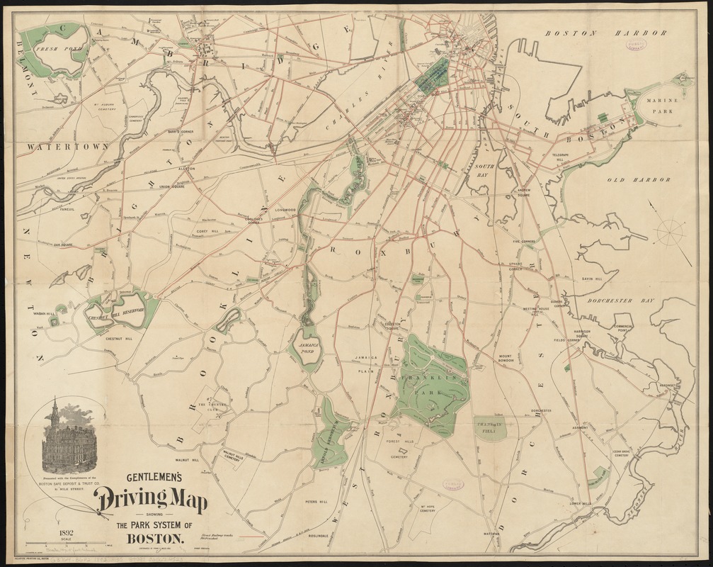
Toward the end of the 19th century, industrial advances made carriages more affordable, leading to increased mobility for many. Pleasure driving in horse-drawn vehicles, a leisure activity once reserved for wealthier Americans, was now a more widely accessible hobby. Olmsted’s parks featured carriage promenades, and the parkways connecting the Emerald Necklace system were designed as pleasure routes for carriages. Produced in 1892, this map shows Boston’s carriage drives, highlighting the park system; the whips emanating from the title hint at the map’s audience. The map also features streetcar routes for those wishing to reach the parks by another, more affordable, means.
- Creator:
- Miles, Frank C.
- Name on Item:
-
Frank C. Miles ; A.N. Houghton, del.
- Date:
-
1892
- Format:
-
Maps/Atlases
- Location:
-
Boston Public Library
Norman B. Leventhal Map Center - Collection (local):
-
Norman B. Leventhal Map Center Collection
- Subjects:
-
Roads--Massachusetts--Boston--Maps
Parks--Massachusetts--Boston--Maps
Boston (Mass.)--Maps
- Places:
-
Suffolk (county)Boston
- Extent:
- 1 map : col. ; 57 x 72 cm., folded in cover 16 x 11 cm.
- Terms of Use:
-
No known copyright restrictions.
No known restrictions on use.
- Publisher:
-
Boston :
Heliotype Print. Co.
- Edition:
- 1st ed.
- Scale:
-
Scale [ca. 1:19,300]
- Language:
-
English
- Notes:
-
Presented with the compliments of the Boston Safe Deposit & Trust Co., 87 Milk Street
- Notes (exhibitions):
-
Exhibited: "Breathing Room: Mapping Boston's Green Spaces" organized by the Norman B. Leventhal Map Center at the Boston Public Library, 2018.
- Identifier:
-
06_01_010473
- Call #:
-
G3764.B6P2 1892 .M55
- Barcode:
-
39999065674523


