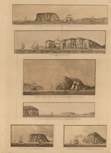
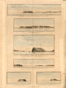
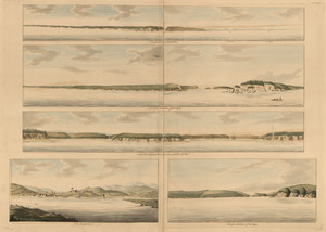
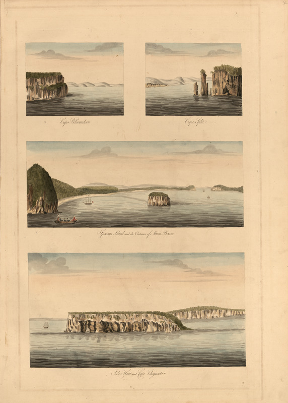
Cape Blowmedown ; Cape Split ; Spencers Island and the entrance of Mines Bason ; Isle Haut and Cape Chegnecto
This map is also available in American Revolutionary Geographies Online (ARGO), a collections portal especially built for material relating to the American Revolutionary War Era. Visit ARGO to learn more about this item and explore the historical geography of North America in the late eighteenth century.
Item Information
- Title:
- Cape Blowmedown ; Cape Split ; Spencers Island and the entrance of Mines Bason ; Isle Haut and Cape Chegnecto
- Publisher:
- Des Barres, Joseph F. W. (Joseph Frederick Wallet), 1722-1824
- Date:
-
1777
- Format:
-
Maps/Atlases
- Location:
- Library of Congress Geography and Map Division
- Collection (local):
-
Library of Congress Geography and Map Division
- Subjects:
-
Coasts--Nova Scotia--Pictorial works
Cape Blowmedown (N.S.)--Pictorial works
Cape Chignecto (N.S.)--Pictorial works
Cape Split (N.S.)--Pictorial works
Isle Haute (N.S.)--Pictorial works
Minas Basin (N.S.)--Pictorial works
- Places:
-
CanadaMinas Basin (bay)
CanadaSplit, Cape
CanadaChignecto, Cape
Isle Haute
Cape Blomidon
- Extent:
- 4 views on 1 sheet : hand col. ; sheet 91 x 62 cm.
- Terms of Use:
-
No known copyright restrictions.
This work is licensed for use under a Creative Commons Attribution Non-Commercial Share Alike License (CC BY-NC-SA).

- Publisher:
-
[London] :
J.F.W. Des Barres
- Language:
-
English
- Catalog Record:
-
https://lccn.loc.gov/75332513
- Notes:
-
Appears in The Atlantic Neptune by Des Barres. London, 1777-[1781].