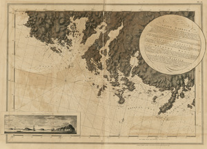
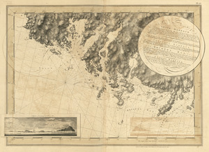
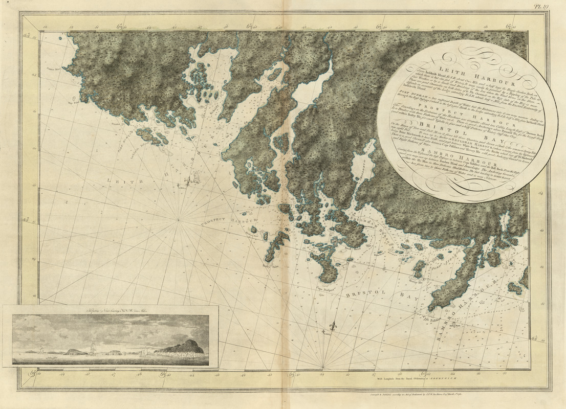
Leith Harbour ; Prospect Harbour ; Bristol Bay ; Sambro Harbour
This map is also available in American Revolutionary Geographies Online (ARGO), a collections portal especially built for material relating to the American Revolutionary War Era. Visit ARGO to learn more about this item and explore the historical geography of North America in the late eighteenth century.
Item Information
- Title:
- Leith Harbour ; Prospect Harbour ; Bristol Bay ; Sambro Harbour
- Publisher:
- Des Barres, Joseph F. W. (Joseph Frederick Wallet), 1722-1824
- Date:
-
1781
- Format:
-
Maps/Atlases
- Location:
- Library of Congress Geography and Map Division
- Collection (local):
-
Library of Congress Geography and Map Division
- Subjects:
-
Coasts--Nova Scotia--Maps
Bristol Bay (N.S.)--Maps
Leith Harbor (N.S.)--Maps
Prospect Harbor (N.S.)--Maps
Sambro Harbor (N.S.)--Maps
- Places:
-
Chezzetcook Inlet
Porter Lake
Musquodoboit Harbour
Cole Harbour
Petpeswick Inlet
- Extent:
- 1 map : hand col. ; 69 x 97 cm.
- Terms of Use:
-
No known copyright restrictions.
This work is licensed for use under a Creative Commons Attribution Non-Commercial Share Alike License (CC BY-NC-SA).

- Publisher:
-
[London] :
J.F.W. Des Barres
- Scale:
-
Scale [ca. 1:28,000]
- Language:
-
English
- Catalog Record:
-
https://lccn.loc.gov/75332518
- Notes:
-
State 5. Date of imprint advanced to March 1, 1781, and tree- and rock-like symbols added over the land area.