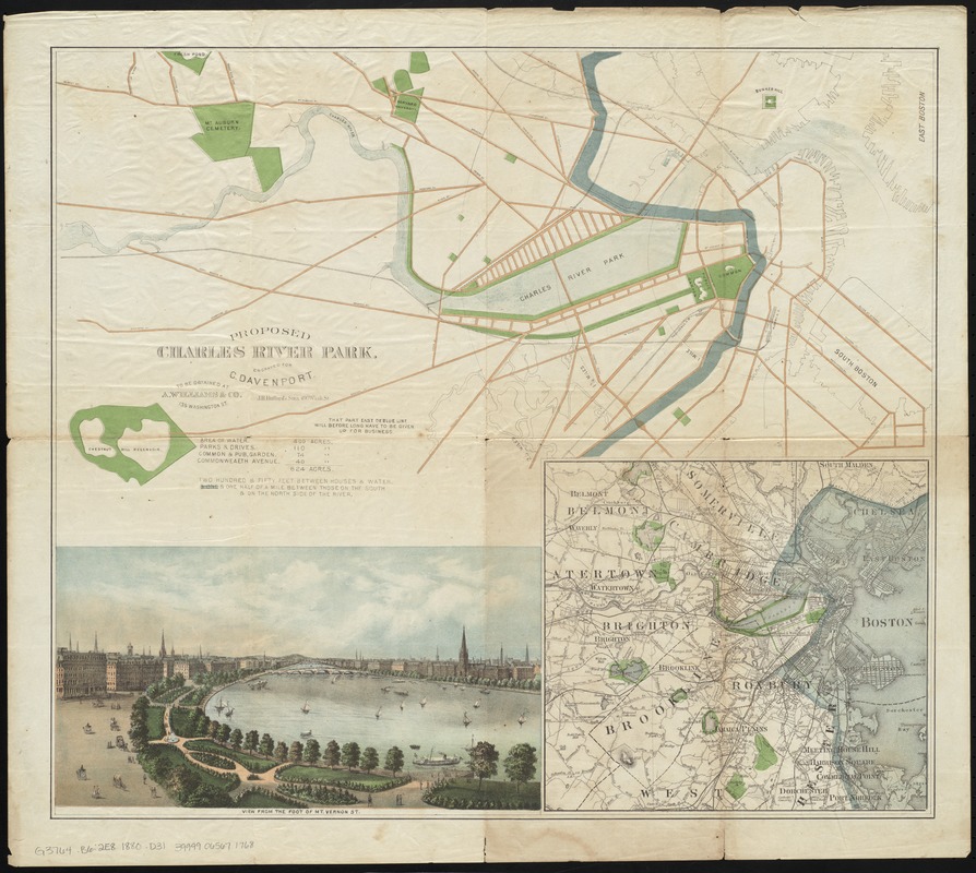
Proposed Charles River Park
Item Information
- Title:
- Proposed Charles River Park
- Creator:
- Davenport, Charles.
- Name on Item:
-
engraved for C. Davenport.
- Date:
-
[1880]
- Format:
-
Maps/Atlases
- Location:
-
Boston Public Library
Norman B. Leventhal Map Center - Collection (local):
-
Norman B. Leventhal Map Center Collection
- Subjects:
-
Parks--Massachusetts--Boston--Maps
Parks--Massachusetts--Cambridge--Maps
City planning--Massachusetts--Boston--Maps
City planning--Massachusetts--Cambridge--Maps
Boston (Mass.)--Maps
Cambridge (Mass.)--Maps
Charles River (Mass.)--Maps
- Places:
-
Middlesex (county)Cambridge
Charles (river)
Suffolk (county)Boston
- Extent:
- 1 map : hand col. ; 48 x 55 cm.
- Terms of Use:
-
No known copyright restrictions.
No known restrictions on use.
- Publisher:
-
[Boston, Mass.] :
J.H. Bufford's Sons
- Scale:
-
Scale [ca. 1:21,000]
- Language:
-
English
- Notes:
-
An earlier proof copy of the map with errors in the legend and manuscript corrections.
Insets: View from the foot of Mt. Vernon St. -- [Boston and vicinity].
Includes radial lines showing distance from the State House and a table listing acreage.
"To be obtained at A. William & Co."
- Notes (date):
-
This date is inferred.
- Identifier:
-
06_01_010378
- Call #:
-
G3764.B6:2E8 1880 .D31
- Barcode:
-
39999065671768


