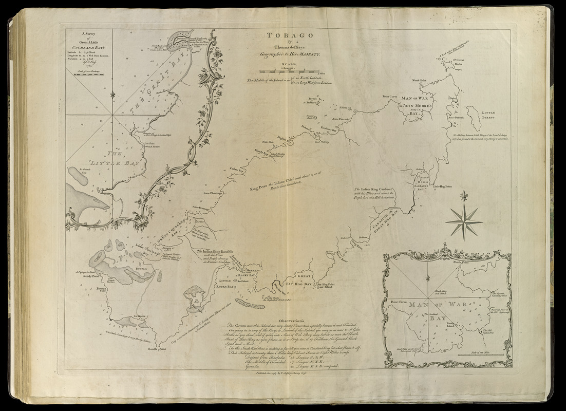
Tobago
This map is also available in American Revolutionary Geographies Online (ARGO), a collections portal especially built for material relating to the American Revolutionary War Era. Visit ARGO to learn more about this item and explore the historical geography of North America in the late eighteenth century.
Item Information
- Title:
- Tobago
- Creator:
- Jefferys, Thomas, -1771
- Contributor:
- Sayer, Robert, 1725-1794
- Contributor:
- Ross, David
- Date:
-
[1768]
- Format:
-
Maps/Atlases
- Location:
-
Boston Public Library
Norman B. Leventhal Map Center - Collection (local):
-
Norman B. Leventhal Map Center Collection
- Subjects:
-
Tobago (Trinidad and Tobago)--Maps--Early works to 1800
- Places:
-
Tobago (island)
- Extent:
- 1 map ; 48 x 63 cm.
- Terms of Use:
-
No known copyright restrictions.
No known restrictions on use.
- Publisher:
-
London :
Printed for Robert Sayer, ... and Thomas Jefferys
- Scale:
-
Scale [ca. 1:57,600]
- Language:
-
English
- Notes:
-
Depths shown by soundings.
Insets: A survey of Great & Little Courland Bays / by -Ross -- Man of War Bay.
Includes notes and explanations.
Appears in Jefferys' General topography of North America and the West Indies. London: Printed for Robert Sayer, ... and Thomas Jefferys, 1768.
- Notes (date):
-
This date is inferred.
- Notes (citation):
-
LC Maps of North America, 2108
Phillips, 1196
- Identifier:
-
4000137_0116
- Call #:
-
G1105 .J4 1768
- Barcode:
-
30000003257068


