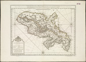
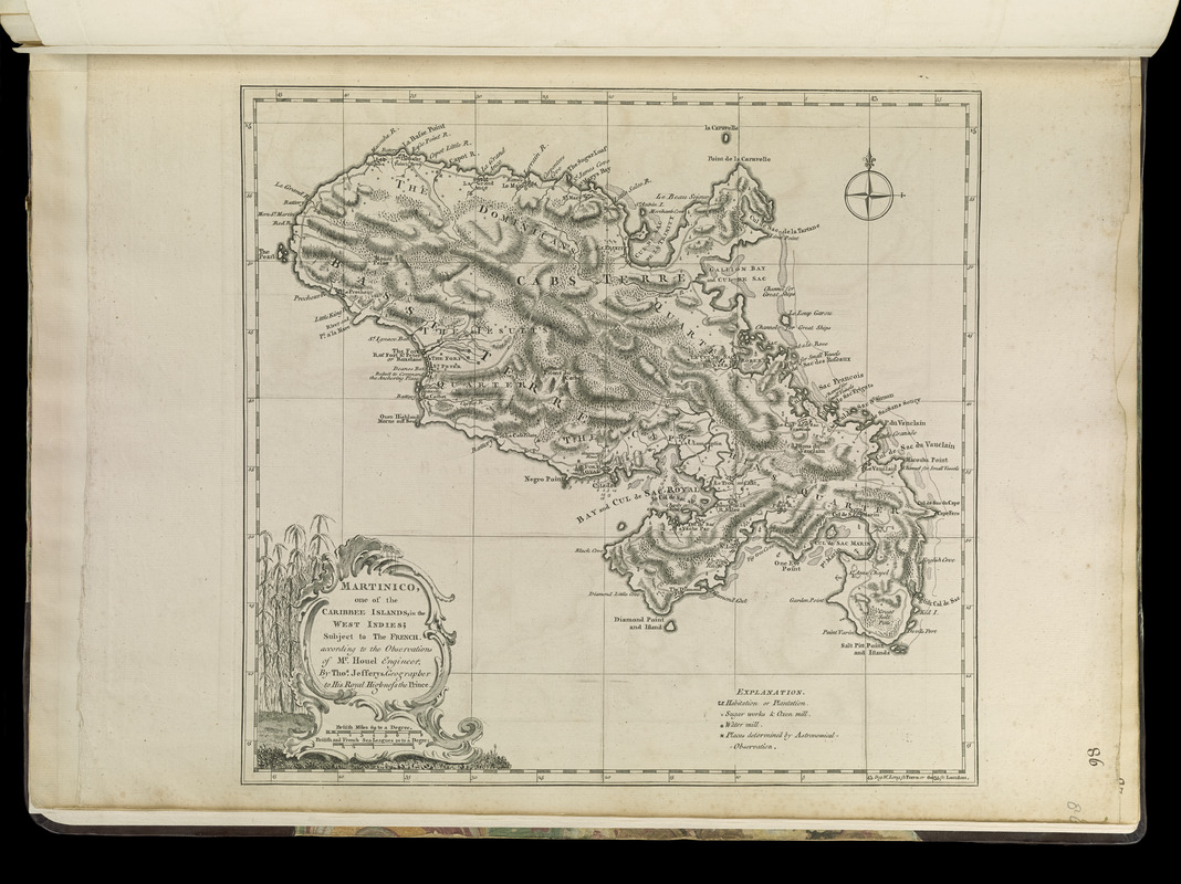
Martinico, one of the Caribbee Islands in the West Indies : subject to the French
This map is also available in American Revolutionary Geographies Online (ARGO), a collections portal especially built for material relating to the American Revolutionary War Era. Visit ARGO to learn more about this item and explore the historical geography of North America in the late eighteenth century.
Item Information
- Title:
- Martinico, one of the Caribbee Islands in the West Indies : subject to the French
- Creator:
- Jefferys, Thomas, -1771
- Contributor:
- Höuel, Jean
- Contributor:
- Sayer, Robert, 1725-1794
- Name on Item:
-
according to the observations of Mr. Houel engineer ; by Thos. Jefferys, geographer to His Royal Highness the Prince
- Date:
-
[1768]
- Format:
-
Maps/Atlases
- Location:
-
Boston Public Library
Norman B. Leventhal Map Center - Collection (local):
-
Norman B. Leventhal Map Center Collection
- Subjects:
-
Martinique--Maps--Early works to 1800
- Places:
-
Martinique (territory)
- Extent:
- 1 map ; 33 x 36 cm.
- Terms of Use:
-
No known copyright restrictions.
No known restrictions on use.
- Publisher:
-
London :
Printed for Robert Sayer, ... and Thomas Jefferys
- Scale:
-
Scale [ca. 1:272,000]
- Language:
-
English
- Notes:
-
Shows anchorages, rocks and shoals, habitations, plantations, sugar works, oxen mills, water mills, and places determined by astronomical observation.
Relief shown by hachures. Depths shown by soundings.
Prime meridians: Ferro and London.
Appears in Jefferys' General topography of North America and the West Indies. London: Printed for Robert Sayer, ... and Thomas Jefferys, 1768.
- Notes (date):
-
This date is inferred.
- Notes (citation):
-
LC Maps of North America, 2048
Phillips, 1196
- Identifier:
-
4000137_0112r
- Call #:
-
G1105 .J4 1768
- Barcode:
-
30000003257064