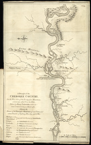
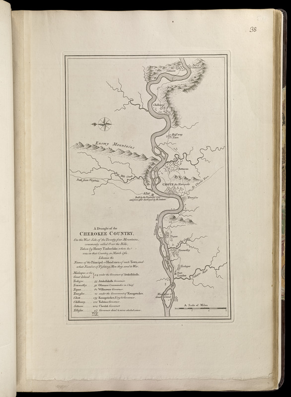
A draught of the Cherokee Country, on the west side of the Twenty Four Mountains, commonly called Over the Hills
Item Information
- Title:
- A draught of the Cherokee Country, on the west side of the Twenty Four Mountains, commonly called Over the Hills
- Creator:
- Timberlake, Henry, -1765
- Contributor:
- Jefferys, Thomas, -1771
- Contributor:
- Sayer, Robert, 1725-1794
- Name on Item:
-
taken by Henry Timberlake, when he was in that country, in Mar. 1762
- Date:
-
[1768]
- Format:
-
Maps/Atlases
- Location:
-
Boston Public Library
Norman B. Leventhal Map Center - Collection (local):
-
Norman B. Leventhal Map Center Collection
- Subjects:
-
Indians of North America--Little Tennessee River Valley (Ga.-Tenn.)--Maps--Early works to 1800
Cherokee Indians--Tennessee--Maps--Early works to 1800
Fort Loudoun State Historic Area (Tenn.)--Maps--Early works to 1800
- Places:
-
Little Tennessee River
- Extent:
- 1 map ; 38 x 23 cm.
- Terms of Use:
-
No known copyright restrictions.
No known restrictions on use.
- Publisher:
-
London :
Printed for Robert Sayer, ... and Thomas Jefferys
- Scale:
-
Scale [ca. 1:64,500]
- Language:
-
English
- Notes:
-
Oriented wiith north to the left.
Relief shown pictorially.
Covers Fort Loudoun and part of the Little Tennessee River.
Includes a list of the "Names of the principal or headmen of each town, and what number of fighting men they send to war."
Appears in Jefferys' General topography of North America and the West Indies. London: Printed for Robert Sayer, ... and Thomas Jefferys, 1768.
- Notes (date):
-
This date is inferred.
- Notes (citation):
-
LC Maps of North America, 1393
- Identifier:
-
4000137_0076
- Call #:
-
G1105 .J4 1768
- Barcode:
-
30000003254697