A map of Canada and the north part of Louisiana with the adjacent countrys
Item Information
- Title:
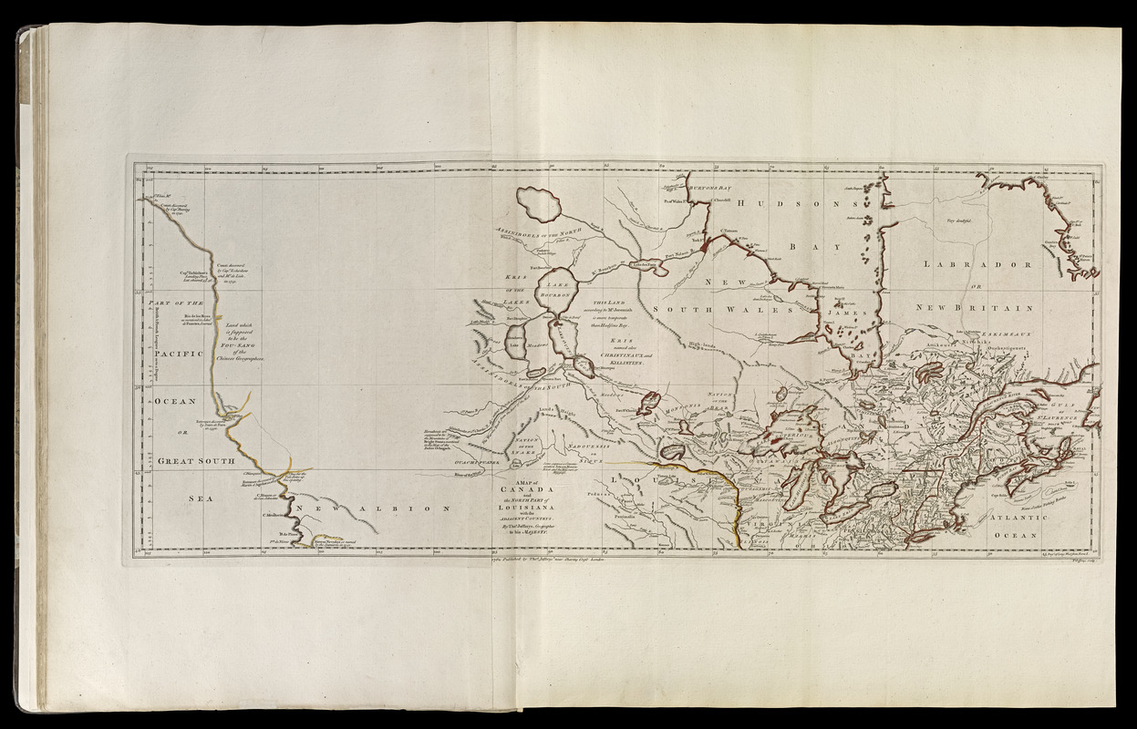
- A map of Canada and the north part of Louisiana with the adjacent countrys
- Creator:
- Jefferys, Thomas, -1771
- Name on Item:
-
by Thos. Jefferys, geographer to His Majesty
- Date:
-
[1768]
- Format:
-
Maps/Atlases
- Location:
-
Boston Public Library
Norman B. Leventhal Map Center - Collection (local):
-
Norman B. Leventhal Map Center Collection
- Subjects:
-
Canada--Maps--Early works to 1800
United States--Maps--Early works to 1800
- Places:
-
United States
Canada
- Extent:
- 1 map : hand col. ; 31 x 77 cm.
- Terms of Use:
-
No known copyright restrictions.
No known restrictions on use.
- Publisher:
-
London :
Thos. Jefferys
- Scale:
-
Scale [ca. 1:8,000,000]
- Language:
-
English
- Notes:
-
Prime meridian: Ferro.
Relief shown pictorially.
Shows southern Canada and northern United States.
Appears in Jefferys' General topography of North America and the West Indies. London: Printed for Robert Sayer, ... and Thomas Jefferys, 1768.
- Notes (date):
-
This date is inferred.
- Notes (citation):
-
LC Maps of North America, 1750-1789, 95
Phillips, 1196
- Identifier:
-
4000137_0024
- Call #:
-
G1105 .J4 1768
- Barcode:
-
30000003253853


