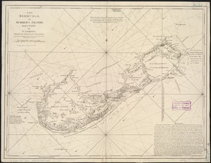
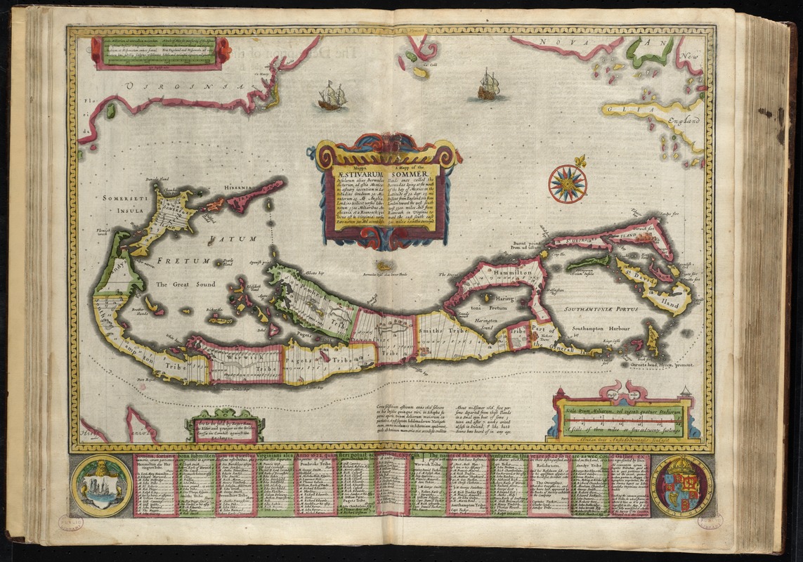
Mappa æstivarum insularum alias Bermudas dictarum, ad ostia Mexicani æstuary iacentium in latitudine graduum 32 minutorum 25 ab Anglia, londino scilicet versus libonotum 3300 miliaribus anglicanis, et a Roanoack (qui locus est in Virginia) versus Euronotum 500 mil. accurate descr. = A mapp of the Sommer Ilands once called the Bermudas lying at the mouth of the bay of Mexico in the lattitude of 32 degr. 25 mi. distant from England viz. from London towards the west south-west 3300 miles and from Roanoack in Virginia toward the est south east 500 miles exactlie surveyed
Item Information
- Title:
- Mappa æstivarum insularum alias Bermudas dictarum, ad ostia Mexicani æstuary iacentium in latitudine graduum 32 minutorum 25 ab Anglia, londino scilicet versus libonotum 3300 miliaribus anglicanis, et a Roanoack (qui locus est in Virginia) versus Euronotum 500 mil. accurate descr. = A mapp of the Sommer Ilands once called the Bermudas lying at the mouth of the bay of Mexico in the lattitude of 32 degr. 25 mi. distant from England viz. from London towards the west south-west 3300 miles and from Roanoack in Virginia toward the est south east 500 miles exactlie surveyed
- Title (alt.):
-
Mapp of the Sommer Ilands once called the Bermudas lying at the mouth of the bay of Mexico in the lattitude of 32 degr. 25 mi. distant from England viz. from London towards the west south-west 3300 miles and from Roanoack in Virginia toward the est south east 500 miles exactlie surveyed
- Creator:
- Speed, John, 1552?-1629
- Name on Item:
-
Abraham Goos Amstelodamensis sculpsit.
- Date:
-
[1662]
- Format:
-
Maps/Atlases
- Location:
-
Boston Public Library
Norman B. Leventhal Map Center - Collection (local):
-
Norman B. Leventhal Map Center Collection
- Subjects:
-
Landowners--Bermuda Islands--Maps--Early works to 1800
Real property--Bermuda Islands--Maps--Early works to 1800
Bermuda Islands--Maps--Early works to 1800
- Places:
-
Bermuda (territory)
- Extent:
- 1 map : hand col. ; 33 x 51 cm.
- Terms of Use:
-
No known copyright restrictions.
No known restrictions on use.
- Publisher:
-
[London] :
Are to be sold by Roger Rea ye elder and younger
- Scale:
-
Scale [ca. 1:50,400-ca. 1:4,875,000]
- Language:
-
English
- Notes:
-
Shows land shareholders.
Oriented with north to the upper right.
Text on verso titled The description of the Sommer Ilands, once called the Bermudas; p. 41-42; printer's signature X.
Includes ill. of ships.
Includes parts of Virginia, Mexico, and England at relative directional positions.
In the author's A prospect of the most famous parts of the world (London, 1662).
Cataloging, conservation, and digitization made possible in part by The National Endowment for the Humanities: Exploring the human endeavor.
- Notes (date):
-
This date is inferred.
- Identifier:
-
06_01_010229
- Call #:
-
G1015 .S64 1662
- Barcode:
-
30000003245356