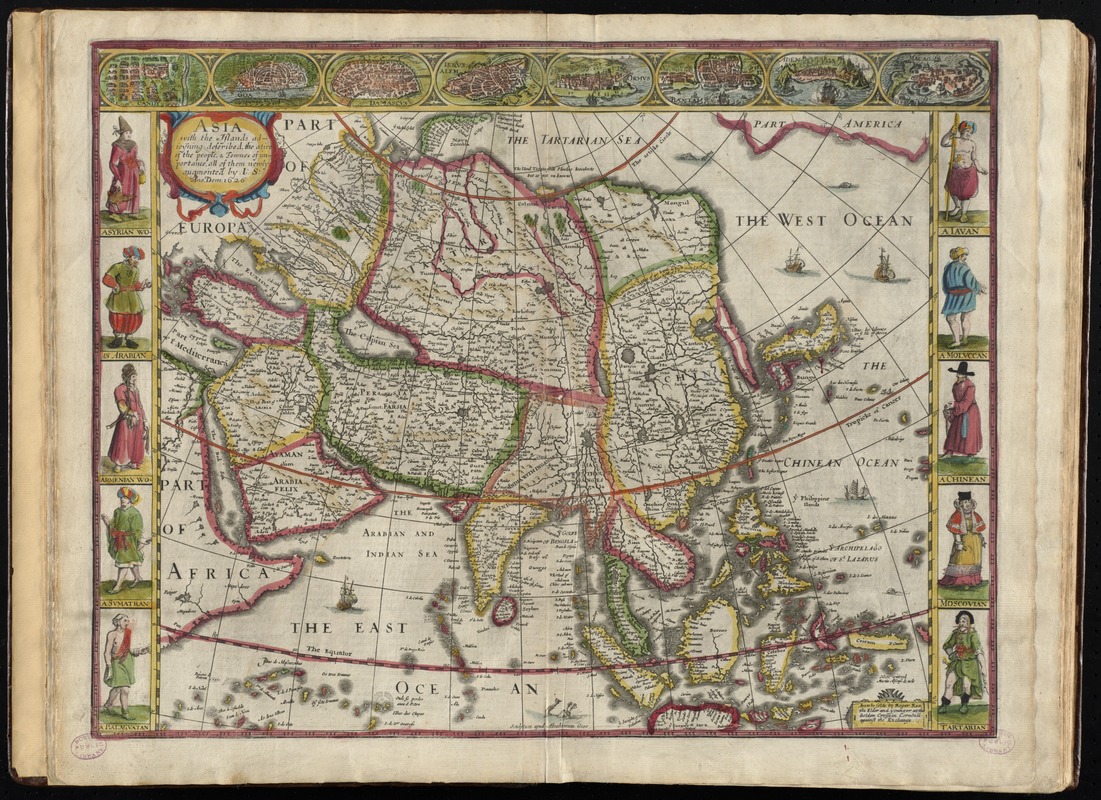
Asia : with the islands adioyning described, the atire of the people, & townes of importance, all of them newly augmented
Item Information
- Title:
- Asia : with the islands adioyning described, the atire of the people, & townes of importance, all of them newly augmented
- Creator:
- Speed, John, 1552?-1629
- Name on Item:
-
by I. S. Ano. Dom. 1626.
- Date:
-
[1662]
- Format:
-
Maps/Atlases
- Location:
-
Boston Public Library
Norman B. Leventhal Map Center - Collection (local):
-
Norman B. Leventhal Map Center Collection
- Subjects:
-
Asia--Maps--Early works to 1800
- Places:
-
Asia
Asia
- Extent:
- 1 map : hand col. ; 35 x 44 cm.
- Terms of Use:
-
No known copyright restrictions.
No known restrictions on use.
- Publisher:
-
[London] :
Are to be solde by Roger Rea the elder and younger
- Scale:
-
Scale [ca. 1:27,000,000] at equator
- Language:
-
English
- Notes:
-
Relief shown pictorially.
Prime meridian: [Ferro].
Text on verso titled The description of Asia; p. 3-4; printer's signature B.
City maps in upper border: Candy -- Goa -- Damascus -- Ierusalem -- Ormus -- Bantam -- Aden -- Macao.
Includes ill. of native peoples in left and right borders.
In the author's A prospect of the most famous parts of the world (London, 1662).
Cataloging, conservation, and digitization made possible in part by The National Endowment for the Humanities: Exploring the human endeavor.
- Notes (date):
-
This date is inferred.
- Identifier:
-
06_01_010225
- Call #:
-
G1015 .S64 1662
- Barcode:
-
30000003245359


