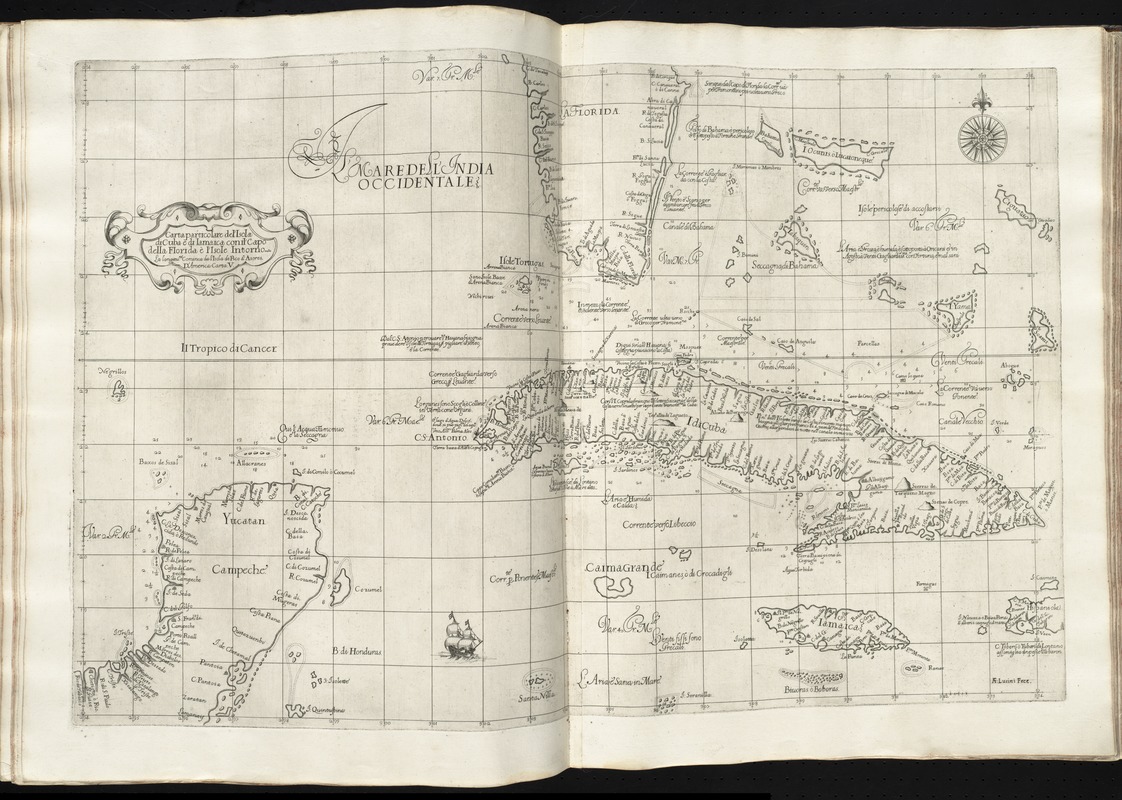
Carta particolare del'Isola di Cuba è di Iamaica con il capo della Florida è l'Isola Intorno
Item Information
- Title:
- Carta particolare del'Isola di Cuba è di Iamaica con il capo della Florida è l'Isola Intorno
- Creator:
- Dudley, Robert, Sir, 1574-1649
- Engraver:
- Lucini, Antonio Francesco, b. 1605
- Date:
-
[1647]
- Format:
-
Maps/Atlases
- Location:
-
Boston Public Library
Norman B. Leventhal Map Center - Collection (local):
-
Norman B. Leventhal Map Center Collection
- Subjects:
-
Coasts--Florida--Maps--Early works to 1800
Coasts--Yucatán Peninsula--Maps--Early works to 1800
Nautical charts--Early works to 1800
Cuba--Maps--Early works to 1800
Jamaica--Maps--Early works to 1800
Antilles, Greater--Maps--Early works to 1800
- Places:
-
Florida
Greater Antilles (area)
Cuba
Yucatan Peninsula (area)
Jamaica
- Extent:
- 1 map ; 48 x 39 cm.
- Terms of Use:
-
No known copyright restrictions.
No known restrictions on use.
- Publisher:
-
Firenze :
Francesco Onofri
- Scale:
-
Scale [ca. 1:2,900,000]
- Language:
-
Italian
- Notes:
-
Covers the Greater Antilles and parts of Florida and the Yucatan Peninsula, showing coastal towns, harbors, prevailing winds, ocean currents, and magnetic deviations of the compass.
Depth shown by soundings.
Prime meridian: Pico.
"D'America carta V."
In Dudley's Dell'arcano del mare, 1646-1647.
Cataloging, conservation, and digitization made possible in part by The National Endowment for the Humanities: Exploring the human endeavor.
- Notes (date):
-
This date is inferred.
- Identifier:
-
06_01_010152
- Call #:
-
G1059 .D84 1647
- Barcode:
-
30000003234598