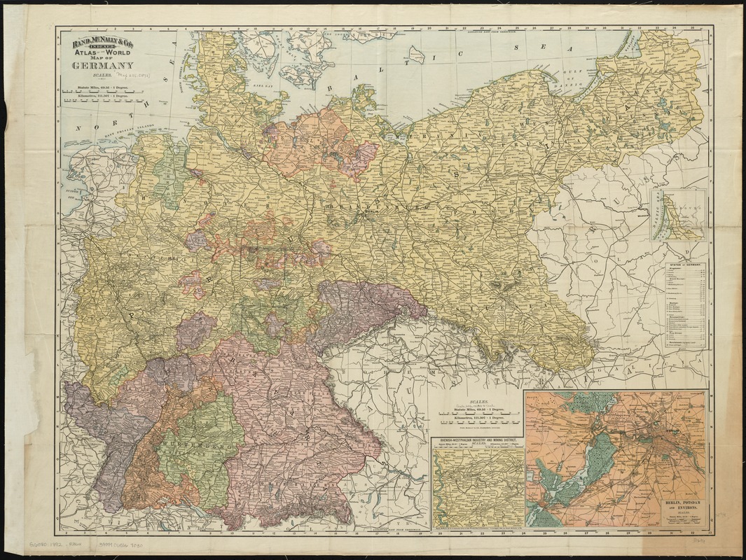
Rand, McNally & Co.'s indexed atlas of the world map of Germany
Item Information
- Title:
- Rand, McNally & Co.'s indexed atlas of the world map of Germany
- Title (alt.):
-
Rand, McNally & Co's Germany
Rand, McNally & Co.'s indexed pocket map of Germany showing the separate states, lakes, mountains, rivers, and railroads
- Creator:
- Rand McNally and Company
- Date:
-
1892
- Format:
-
Maps/Atlases
- Location:
-
Boston Public Library
Norman B. Leventhal Map Center - Collection (local):
-
Norman B. Leventhal Map Center Collection
- Subjects:
-
Germany--Maps
- Places:
-
Germany
- Extent:
- 1 map : col. ; 65 x 84 cm. + index (58 p. ; 16 cm.)
- Terms of Use:
-
No known copyright restrictions.
No known restrictions on use.
- Publisher:
-
Chicago :
Rand, McNally & Co.
- Scale:
-
Scale [ca. 1:1,413,000]
- Language:
-
English
- Notes:
-
Relief shown by hachures.
Insets: Rhenish-Westphalian industry and mining district -- Berlin, Potsdam and environs -- [Northern continuation].
Accompanied by index: Rand, McNally & Co.'s indexed pocket map of Germany.
- Identifier:
-
06_01_009993
- Call #:
-
G6080 1892 .R36x
- Barcode:
-
39999065667030