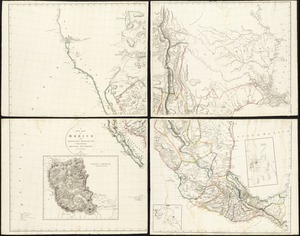
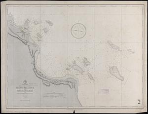
Vera-Cruz dans le Golfe du Méxique [and] Isle St. Juan, Fort de St. Jean d'Ulloa
![Vera-Cruz dans le Golfe du Méxique [and] Isle St. Juan, Fort de St. Jean d'Ulloa](https://bpldcassets.blob.core.windows.net/derivatives/images/commonwealth:cj82kx24p/image_access_800.jpg)
This map is also available in American Revolutionary Geographies Online (ARGO), a collections portal especially built for material relating to the American Revolutionary War Era. Visit ARGO to learn more about this item and explore the historical geography of North America in the late eighteenth century.
Item Information
- Title:
- Vera-Cruz dans le Golfe du Méxique [and] Isle St. Juan, Fort de St. Jean d'Ulloa
- Creator:
- Le Rouge, Georges-Louis.
- Date:
-
[1755]
- Format:
-
Maps/Atlases
- Location:
-
Boston Public Library
Norman B. Leventhal Map Center - Collection (local):
-
Norman B. Leventhal Map Center Collection
- Subjects:
-
San Juan de Ulúa Island (Mexico)--Maps
Veracruz (Veracruz-Llave, Mexico)--Maps
- Places:
-
VeracruzVeracruz
- Extent:
- 1 map ; 17 x 12 cm.
- Terms of Use:
-
No known copyright restrictions.
No known restrictions on use.
- Publisher:
-
Paris :
Le Rouge
- Scale:
-
Scale [1:14,000]
- Language:
-
French
- Notes:
-
Appears in the author's Recueil des plans de l'Amerique Septentrionale.
- Notes (date):
-
This date is inferred.
- Identifier:
-
06_01_009940
- Call #:
-
G1105 .L47 1777
- Barcode:
-
30000003914077