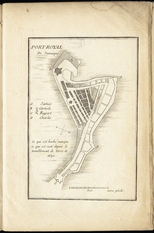
Port-Royal de Jamaique
This map is also available in American Revolutionary Geographies Online (ARGO), a collections portal especially built for material relating to the American Revolutionary War Era. Visit ARGO to learn more about this item and explore the historical geography of North America in the late eighteenth century.
Item Information
- Title:
- Port-Royal de Jamaique
- Creator:
- Le Rouge, Georges-Louis.
- Date:
-
[1755]
- Format:
-
Maps/Atlases
- Location:
-
Boston Public Library
Norman B. Leventhal Map Center - Collection (local):
-
Norman B. Leventhal Map Center Collection
- Subjects:
-
Port Royal (Jamaica)--Maps--Early works to 1800
- Places:
-
Kingston (county)Port Royal
- Extent:
- 1 map ; 18 x 12 cm.
- Terms of Use:
-
No known copyright restrictions.
No known restrictions on use.
- Publisher:
-
Paris :
Le Rouge
- Scale:
-
Scale [ca. 1:7,700]
- Language:
-
French
- Notes:
-
Oriented with north toward the lower right.
From the author's Recueil des plans de l'Amerique Septentrionale. 1755.
"Ce qui est haché marque ce qui est reste depuis le tremblement de terre de 1692."
Indexed for forts.
- Notes (date):
-
This date is inferred.
- Identifier:
-
06_01_009941
- Call #:
-
G1105 .L47 1777
- Barcode:
-
30000003914075
- LCCN:
-
73691840


