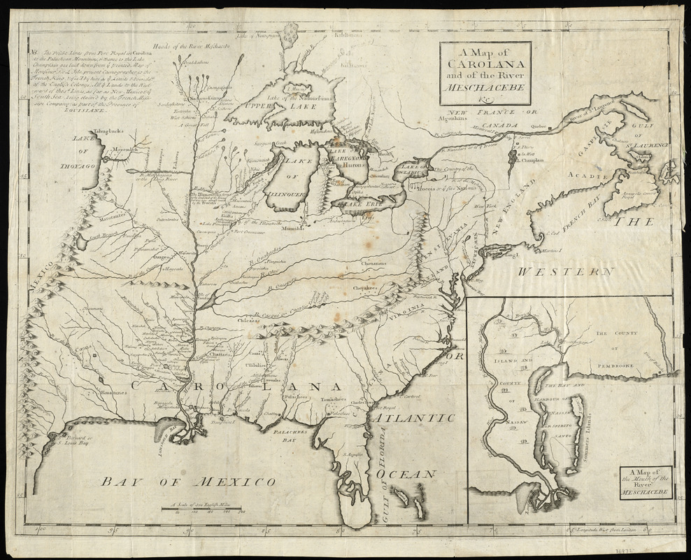
A map of Carolana and of the river Meschacebe &c
Item Information
- Title:
- A map of Carolana and of the river Meschacebe &c
- Creator:
- Coxe, Daniel, 1673-1739
- Date:
-
[1741]
- Format:
-
Maps/Atlases
- Location:
-
Boston Public Library
Norman B. Leventhal Map Center - Collection (local):
-
Norman B. Leventhal Map Center Collection
- Subjects:
-
Mississippi River Valley--Maps--Early works to 1800
United States--Maps--Early works to 1800
- Places:
-
Mississippi River
- Extent:
- 1 map ; 43 x 55 cm.
- Terms of Use:
-
No known copyright restrictions.
No known restrictions on use.
- Publisher:
-
London :
O. Payne
- Scale:
-
Scale [ca. 1:7,350,000]
- Language:
-
English
- Notes:
-
Relief shown pictorially.
Inset: A map of the mouth of the river Meschacebe.
From Coxe's Collection of voyages & travels (London : O. Payne, 1741).
- Notes (date):
-
This date is inferred.
- Identifier:
-
06_01_009908
- Call #:
-
BPL Rare Books Dept. G.166.C87
- Barcode:
-
30000003908659


