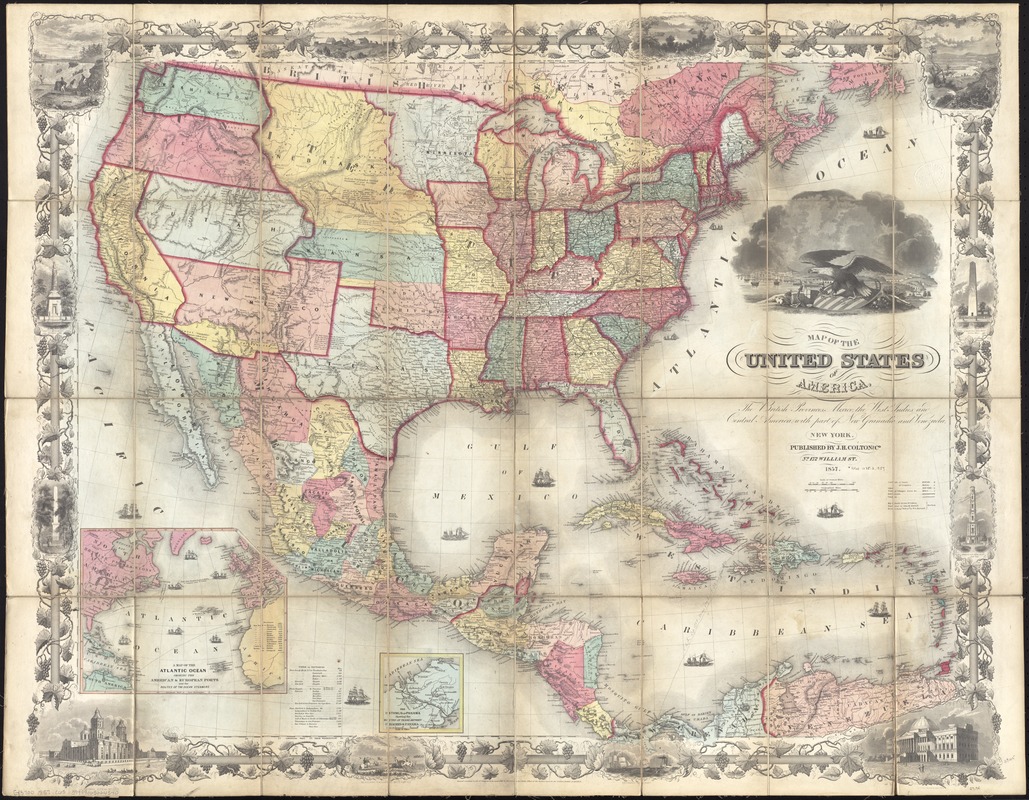
Map of the United States of America, the British provinces, Mexico, the West Indies and Central America, with part of New Granada and Venezuela
Item Information
- Title:
- Map of the United States of America, the British provinces, Mexico, the West Indies and Central America, with part of New Granada and Venezuela
- Title (alt.):
-
Colton's map of the United States, Mexico &c
- Creator:
- Colton, G. Woolworth (George Woolworth), 1827-1901
- Name on Item:
-
map drawn by Geo. W. Colton ; engraved by John M. Atwood ; border desig'd & eng'd. by W.S. Barnard.
- Date:
-
1857
- Format:
-
Maps/Atlases
- Location:
-
Boston Public Library
Norman B. Leventhal Map Center - Collection (local):
-
Norman B. Leventhal Map Center Collection
- Subjects:
-
Railroads--United States--Maps
United States--Maps
Mexico--Maps
Central America--Maps
West Indies--Maps
- Places:
-
Mexico
Mesoamerica (area)
West Indies
- Extent:
- 1 map : hand col. ; 77 x 97 cm., folded in case 23 x 15 cm.
- Terms of Use:
-
No known copyright restrictions.
No known restrictions on use.
- Publisher:
-
New York :
J.H. Colton and Co.
- Scale:
-
Scale [ca. 1:6,500,000].
- Language:
-
English
- Notes:
-
Relief shown by hachures.
Prime meridians: Washington and Greenwich.
Insets: A map of the Atlantic Ocean showing the America & European ports and the routes of the ocean steamers -- The Isthmus of Panama showing the routes of travel between Chagres & Panama.
Includes table of distances and ill.
- Identifier:
-
06_01_009885
- Call #:
-
G3700 1857 .C65
- Barcode:
-
39999065664540


