New map of New York City : from the latest authentic surveys, showing all ferries, and all steamship docks both foreign and coastwise lines
Item Information
- Title:
- New map of New York City : from the latest authentic surveys, showing all ferries, and all steamship docks both foreign and coastwise lines
- Creator:
- Rand McNally and Company
- Date:
-
[1892]
- Format:
-
Maps/Atlases
- Location:
-
Boston Public Library
Norman B. Leventhal Map Center - Collection (local):
-
Norman B. Leventhal Map Center Collection
- Subjects:
-
Local transit--New York (State)--New York--Maps
Ferries--New York (State)--New York--Maps
Railroads--New York (State)--New York--Maps
New York (N.Y.)--Maps
Manhattan (New York, N.Y.)--Maps
- Places:
-
New York
- Extent:
- 1 map : col. ; 49 x 31 cm., folded to 32 x 28 cm.
- Terms of Use:
-
No known copyright restrictions.
No known restrictions on use.
- Publisher:
-
Chicago :
Rand, McNally & Co.
- Scale:
-
Scale [ca. 1:24,000]
- Language:
-
English
- Notes:
-
Date of publication based on date of initial receipt and date the hotel was acquired by the proprietor.
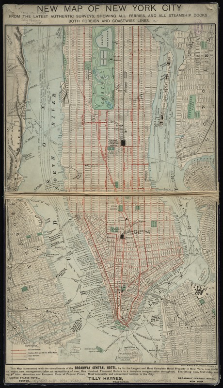
Covers Manhattan Island (south of 96th Street) and adjacent cross-river districts.
Relief shown by hachures.
Shows radial distances from City Hall.
"Compliments of the Broadway Central Hotel ... Tilly Haynes, proprietor."
Text, ill., and advertisement on verso.
- Notes (date):
-
This date is inferred.
- Identifier:
-
06_01_009883
- Call #:
-
G3804.N4P1 1892 .R36x
- Barcode:
-
39999065664763


