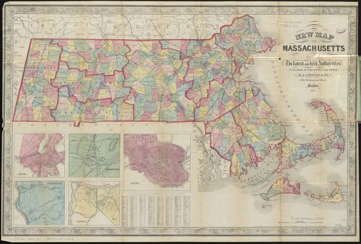
New map of Massachusetts compiled from the latest and best authorities
Item Information
- Title:
- New map of Massachusetts compiled from the latest and best authorities
- Title (alt.):
-
E. P. Dutton & Co's map of Massachusetts with railroads & townships
- Creator:
- E.P. Dutton (Firm)
- Date:
-
1863
- Format:
-
Maps/Atlases
- Location:
-
Boston Public Library
Norman B. Leventhal Map Center - Collection (local):
-
Norman B. Leventhal Map Center Collection
- Subjects:
-
Massachusetts--Maps
- Places:
-
Massachusetts
- Extent:
- 1 map : hand col. ; 46 x 72 cm., folded in cover 15 x 10 cm.
- Terms of Use:
-
No known copyright restrictions.
No known restrictions on use.
- Publisher:
-
Boston :
Published at the Boston Map Store [by] E.P. Dutton & Co.
- Scale:
-
Scale [ca. 1:420,000]
- Language:
-
English
- Notes:
-
Shows some buildings, factories, railroads and roads.
Relief shown by hachures.
Insets: Salem -- Worcester -- Boston -- Springfield -- Lowell.
Includes table of distances.
- Identifier:
-
06_01_009817
- Call #:
-
G3760 1863 .E17
- Barcode:
-
39999065709303


