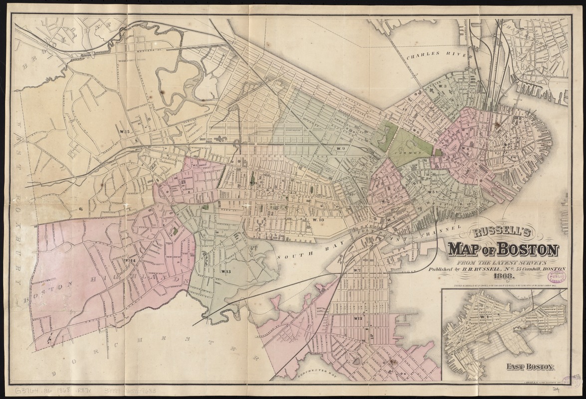
Russell's map of Boston from the latest surveys
Item Information
- Title:
- Russell's map of Boston from the latest surveys
- Title (alt.):
-
Map of Boston
- Creator:
- Russell, B. B. (Benjamin B.)
- Date:
-
1868
- Format:
-
Maps/Atlases
- Location:
-
Boston Public Library
Norman B. Leventhal Map Center - Collection (local):
-
Norman B. Leventhal Map Center Collection
- Subjects:
-
Boston (Mass.)--Maps
- Places:
-
Suffolk (county)Boston
- Extent:
- 1 map : hand col. ; 40 x 61 cm., folded in cover 14 x 9 cm.
- Terms of Use:
-
No known copyright restrictions.
No known restrictions on use.
- Publisher:
-
Boston :
B.B. Russell
- Scale:
-
Scale [ca. 1:12,000]
- Language:
-
English
- Notes:
-
Shows wards and railroads.
Relief shown by hachures.
Oriented with north to the upper right.
Inset: East Boston.
"Entered according to act of Congress in the year 1868 by B.B. Russell in the clerk's office of the District Court of Mass."
- Identifier:
-
06_01_009792
- Call #:
-
G3764.B6 1868 .R87x
- Barcode:
-
39999065709683


