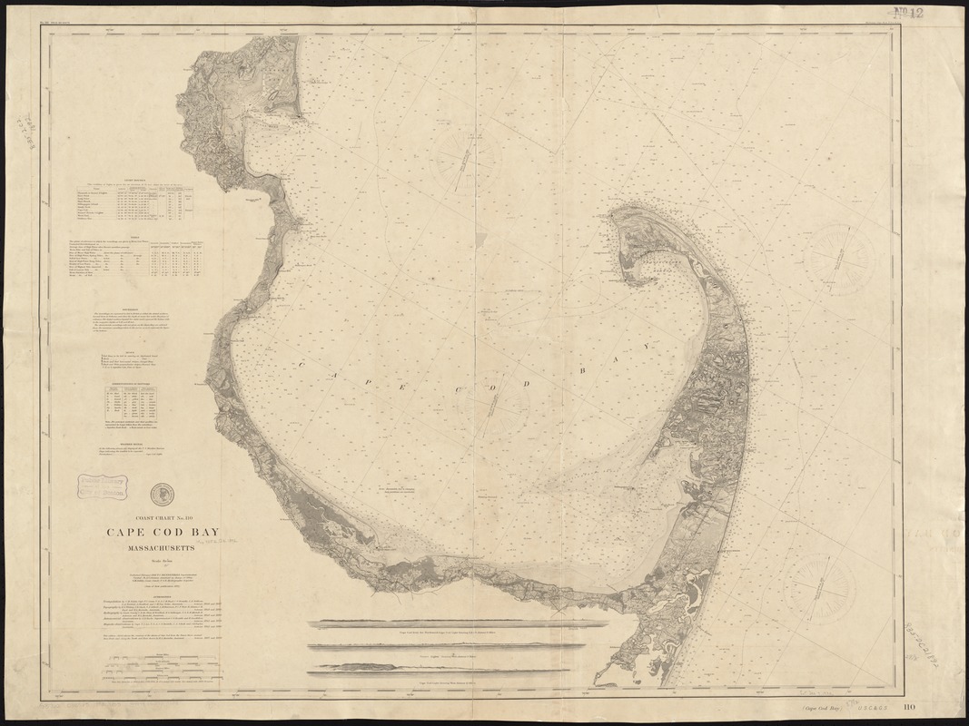
Cape Cod Bay, Massachusetts
Item Information
- Title:
- Cape Cod Bay, Massachusetts
- Creator:
- U.S. Coast and Geodetic Survey
- Date:
-
1892
- Format:
-
Maps/Atlases
- Location:
-
Boston Public Library
Norman B. Leventhal Map Center - Collection (local):
-
Norman B. Leventhal Map Center Collection
- Subjects:
-
Nautical charts--Massachusetts--Cape Cod Bay
Nautical charts--Massachusetts--Duxbury Bay
Cape Cod Bay (Mass.)--Navigation
Duxbury Bay (Mass.)--Navigation
- Places:
-
Cape Cod Bay
Plymouth (county)Duxbury Bay
- Extent:
- 1 map ; 76 x 96 cm.
- Terms of Use:
-
No known copyright restrictions.
No known restrictions on use.
- Publisher:
-
[Washington, D.C.?] :
United States Coast and Geodetic Survey
- Scale:
-
Scale 1:80,000
- Language:
-
English
- Notes:
-
Published February 1892.
Oriented with north to the upper right.
Relief shown by hachures.
Depths shown by gradient tints, isolines and soundings.
Includes 3 profiles.
- Identifier:
-
06_01_009767
- Call #:
-
G3701.P5 svar .U5 no. 110 1892
- Barcode:
-
39999065709808


