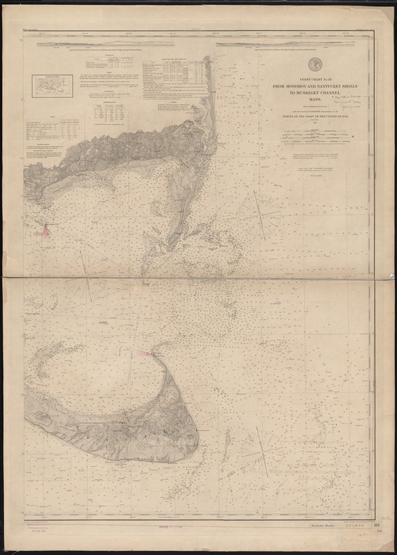
From Monomoy and Nantucket Shoals to Muskeget Channel, Mass
Item Information
- Title:
- From Monomoy and Nantucket Shoals to Muskeget Channel, Mass
- Title (alt.):
-
Monomoy and Nantucket Shoals to Muskeget Channel, Mass
Nantucket Shoals
- Creator:
- U.S. Coast and Geodetic Survey
- Name on Item:
-
from a trigonometrical survey under the direction of A.D. Bache ; engd' by A. Sengteller, G. McCoy, W. Phillips and E. A. Menkel.
- Date:
-
1888
- Format:
-
Maps/Atlases
- Location:
-
Boston Public Library
Norman B. Leventhal Map Center - Collection (local):
-
Norman B. Leventhal Map Center Collection
- Subjects:
-
Nautical charts--Massachusetts--Nantucket Sound
Nantucket Sound (Mass.)--Maps
- Places:
-
Dukes (county)Nantucket Sound (bay)
- Extent:
- 1 map ; 93 x 68 cm.
- Terms of Use:
-
No known copyright restrictions.
No known restrictions on use.
- Publisher:
-
[Washington] :
U.S. Coast and Geodetic Survey
- Scale:
-
Scale 1:80,000
- Language:
-
English
- Notes:
-
Relief shown by hachures and shading.
Depths shown by soundings and shading.
Includes buoys, bottom types, light houses and beacons, light vessels, weather signal stations, tides, diagram of charts, and two coastal views.
Stamped in lower margin: Aids to navigation corrected for information received to Apr. 28 1890 -- Printed Apr 18 1890.
- Identifier:
-
06_01_009764
- Call #:
-
G3701.P5 svar .U5 no. 111 1888
- Barcode:
-
39999065663039


