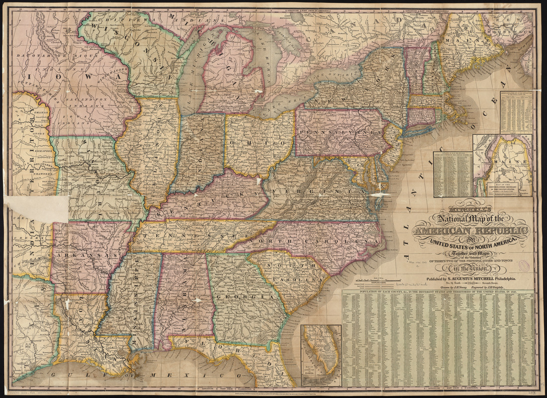
Mitchell's national map of the American Republic or United States of North America : together with maps of the vicinities of thirty-two of the principal cities and towns in the Union
Item Information
- Title:
- Mitchell's national map of the American Republic or United States of North America : together with maps of the vicinities of thirty-two of the principal cities and towns in the Union
- Title (alt.):
-
Mitchell's national map of the United States
- Creator:
- Young, J. H. (James Hamilton)
- Contributor:
- Mitchell, S. Augustus (Samuel Augustus), 1792-1868
- Contributor:
- Brightly, Joseph H., 1818-1901
- Name on Item:
-
drawn by J.H. Young ; engraved by J.H. Brightly
- Date:
-
1843
- Format:
-
Maps/Atlases
- Location:
-
Boston Public Library
Norman B. Leventhal Map Center - Collection (local):
-
Norman B. Leventhal Map Center Collection
- Subjects:
-
United States--Maps
- Places:
-
United States
- Extent:
- 1 map : hand col. ; 62 x 84 cm., folded in cover 19 x 12 cm. + 1 sheet (col. ; 66 x 89 cm.)
- Terms of Use:
-
No known copyright restrictions.
No known restrictions on use.
- Publisher:
-
Philadelphia :
S. Augustus Mitchell
- Scale:
-
Scale [ca. 1:3,375,000]
- Language:
-
English
- Notes:
-
Shows the United States east of Texas.
Relief shown by hachures.
Prime meridian: Washington, D.C.
Insets: Map of the north-eastern boundary of the United States -- Map of the southern part of Florida.
Includes 2 population tables.
Accompanied by sheet of 32 city vicinity maps with population and resource tables.
- Identifier:
-
06_01_009707
- Call #:
-
G3700 1843 .Y68
- Barcode:
-
39999065663542


