Map of Kentucky and Tennessee
Item Information
- Title:
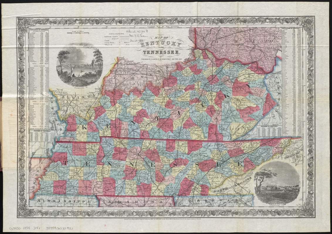
- Map of Kentucky and Tennessee
- Creator:
- J.H. Colton & Co
- Date:
-
1854
- Format:
-
Maps/Atlases
- Location:
-
Boston Public Library
Norman B. Leventhal Map Center - Collection (local):
-
Norman B. Leventhal Map Center Collection
- Subjects:
-
Kentucky--Maps
Tennessee--Maps
- Places:
-
Kentucky
Tennessee
- Extent:
- 1 map : col. ; 35 x 54 cm., folded in cover 15 x 10 cm.
- Terms of Use:
-
No known copyright restrictions.
No known restrictions on use.
- Publisher:
-
New York :
J.H. Colton
- Scale:
-
Scale [ca. 1:1,900,000]
- Language:
-
English
- Notes:
-
Relief shown by hachures.
Prime meridians: Greenwich and Washington.
Includes population tables and views of Louisville and Nashville.
"Entered according to Act of Congress in the year 1852 by J.H. Colton ..."
- Identifier:
-
06_01_009838
- Call #:
-
G3950 1854 .J14x
- Barcode:
-
39999065709121