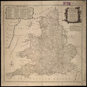
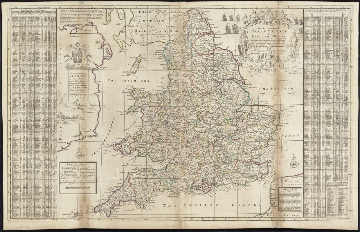
The south part of Great Britain, called England and Wales
Item Information
- Title:
- The south part of Great Britain, called England and Wales
- Creator:
- Moll, Herman, d. 1732
- Name on Item:
-
according to ye most approved surveys, and accurate observations by Herman Moll.
- Date:
-
[1750?–1759?]
- Format:
-
Maps/Atlases
- Location:
-
Boston Public Library
Norman B. Leventhal Map Center - Collection (local):
-
Norman B. Leventhal Map Center Collection
- Subjects:
-
England--Maps--Early works to 1800
Wales--Maps--Early works to 1800
- Places:
-
Wales
England
- Extent:
- 1 map : hand col. ; 60 x 97 cm.
- Terms of Use:
-
No known copyright restrictions.
No known restrictions on use.
- Publisher:
-
[London] :
Printed for H. Moll ... [by] I. Bowles & Son ... and Tho. Bowles ; sold by Robt. Sayer ... and by John King
- Scale:
-
Scale [ca. 1:1,080,000]
- Language:
-
English
- Notes:
-
Relief shown pictorially.
Includes index with other information about the town, such as market days and distance from London.
Dedicated to Francis, Lord Viscount Rialton.
Appears in Moll's The world described, [1709-1736], plate 17.
- Identifier:
-
06_01_009675
- Call #:
-
G1015 .M65 1709
- Barcode:
-
30000003877372