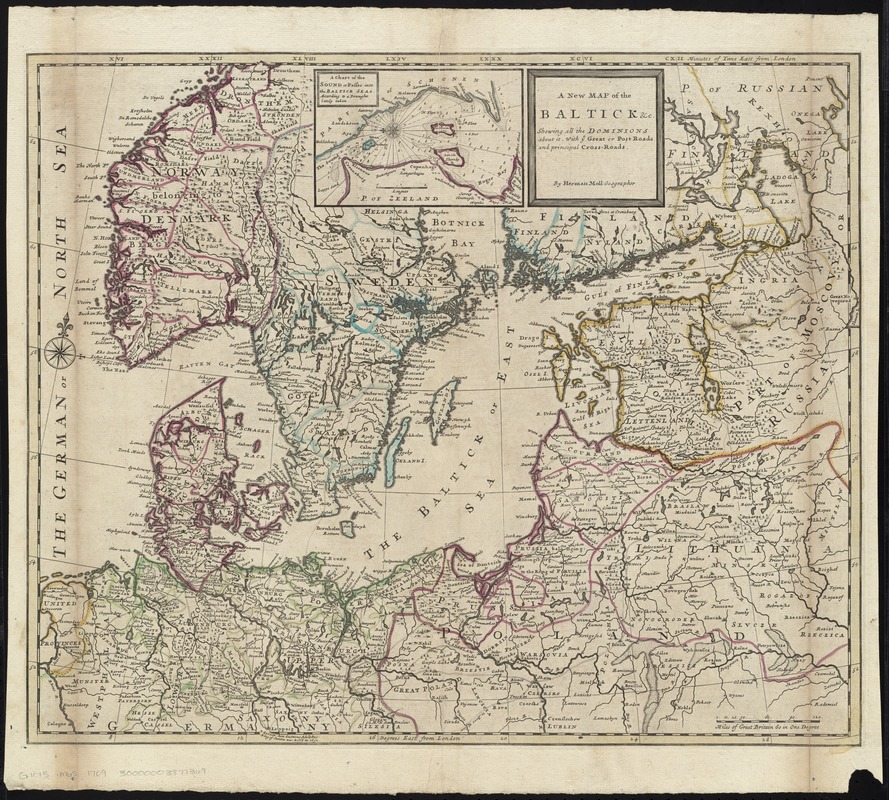
A new map of the Baltick &c : shewing all the dominions about it with ye great or post roads and principal cross-roads
Item Information
- Title:
- A new map of the Baltick &c : shewing all the dominions about it with ye great or post roads and principal cross-roads
- Creator:
- Moll, Herman, d. 1732
- Name on Item:
-
by Herman Moll Geographer.
- Date:
-
[ca. 1720]
- Format:
-
Maps/Atlases
- Location:
-
Boston Public Library
Norman B. Leventhal Map Center - Collection (local):
-
Norman B. Leventhal Map Center Collection
- Subjects:
-
Baltic States--Maps--Early works to 1800
Scandinavia--Maps--Early works to 1800
Germany--Maps--Early works to 1800
Poland--Maps--Early works to 1800
- Places:
-
Germany
Baltic Countries (area)
Scandinavia (area)
Poland
- Extent:
- 1 map : hand col. ; 50 x 61 cm.
- Terms of Use:
-
No known copyright restrictions.
No known restrictions on use.
- Publisher:
-
London :
Herman Moll
- Scale:
-
Scale [ca. 1:2,900,000]
- Language:
-
English
- Notes:
-
Relief shown pictorially.
Inset: A chart of the sound or passes into the Baltick Seas according to a draught lately taken.
Appears in Moll's The world described, [1709-1736], plate 15.
- Identifier:
-
06_01_009677
- Call #:
-
G1015 .M65 1709
- Barcode:
-
30000003877369
![Regni Sueciae tabula generalis, divisa in Sueciae, Gotiaeq[ue] regna Finniae ducatum Lapponiam, Livoniam Ingrianq[ue] et in omnes subiacentes provincias](https://bpldcassets.blob.core.windows.net/derivatives/images/commonwealth:cj82kt14t/image_thumbnail_300.jpg)


