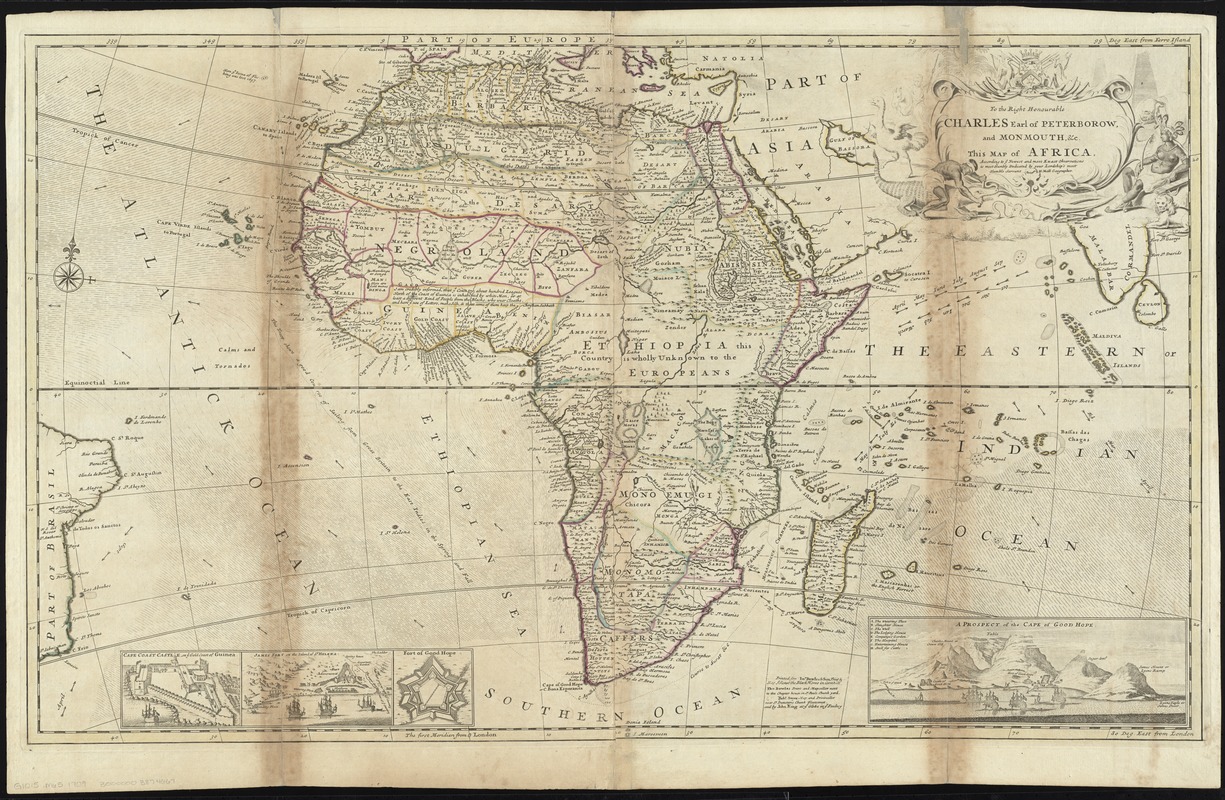
To the Right Honourable Charles, Earl of Peterborow, and Monmouth, &c. this map of Africa, according to ye newest and most exact observations is most humbly dedicated
Item Information
- Title:
- To the Right Honourable Charles, Earl of Peterborow, and Monmouth, &c. this map of Africa, according to ye newest and most exact observations is most humbly dedicated
- Title (alt.):
-
This map of Africa
Africa
- Creator:
- Moll, Herman, d. 1732
- Name on Item:
-
by your Lordship's humble servant H: Moll geographer.
- Date:
-
[1750?–1759?]
- Format:
-
Maps/Atlases
- Location:
-
Boston Public Library
Norman B. Leventhal Map Center - Collection (local):
-
Norman B. Leventhal Map Center Collection
- Subjects:
-
Africa--Maps--Early works to 1800
Peterborough, Charles Mordaunt, Earl of, 1708-1779
- Places:
-
Africa
Africa
- Extent:
- 1 map : hand col. ; 57 x 96 cm.
- Terms of Use:
-
No known copyright restrictions.
No known restrictions on use.
- Publisher:
-
[London] :
Printed for Ino. Bowles & Son ... Tho. Bowles ... [by] Robt. Sayer ... and by John King
- Scale:
-
Scale [ca. 1:16,500,000] at equator
- Language:
-
English
- Notes:
-
Prime meridians: London and Ferro.
Relief shown pictorially.
Insets: Cape Coast Castle on ye gold coast of Guinea -- James Fort on the island of St. Helena -- Fort of Good Hope -- A prospect of the Cape of Good Hope.
Philip Overton's name has been erased and Robert Sayer's printed over. The premises passed to Sayer in 1748.
Appears in Moll's The world described, [1709-1736], plate 6.
- Identifier:
-
06_01_009654
- Call #:
-
G1015 .M65 1709
- Barcode:
-
30000003874667


