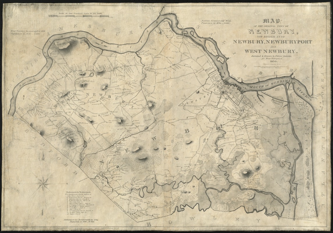
Map of the original town of Newbury, now divided into Newbury, Newburyport and West Newbury
Item Information
- Title:
- Map of the original town of Newbury, now divided into Newbury, Newburyport and West Newbury
- Creator:
- Anderson, Philander.
- Name on Item:
-
surveyed & drawn by Philanr. Anderson for Moses Pettingell, in 1830.
- Date:
-
1831
- Format:
-
Maps/Atlases
- Location:
-
Boston Public Library
Norman B. Leventhal Map Center - Collection (local):
-
Norman B. Leventhal Map Center Collection
- Series:
- Caldwell Collection of Massachusetts Town Plans
- Subjects:
-
Real property--Massachusetts--Newburyport--Maps
Real property--Massachusetts--Newbury--Maps
Real property--Massachusetts--West Newbury (Town)--Maps
Newburyport (Mass.)--Maps
Newbury (Mass.)--Maps
West Newbury (Mass. : Town)--Maps
- Places:
-
Essex (county)Newburyport
Essex (county)Newbury
Essex (county)West Newbury
- Extent:
- 1 map ; 64 x 92 cm.
- Terms of Use:
-
No known copyright restrictions.
No known restrictions on use.
- Publisher:
-
[Boston] :
Moses Pettingell
- Scale:
-
Scale [1:19,800]. 100 rods = 1 in.
- Language:
-
English
- Notes:
-
Relief shown by shading and hachures.
Shows landowners.
Includes references to points of interest.
- Identifier:
-
06_01_009637
- Call #:
-
G3764.N48 1830 .A53
- Barcode:
-
39999065663849