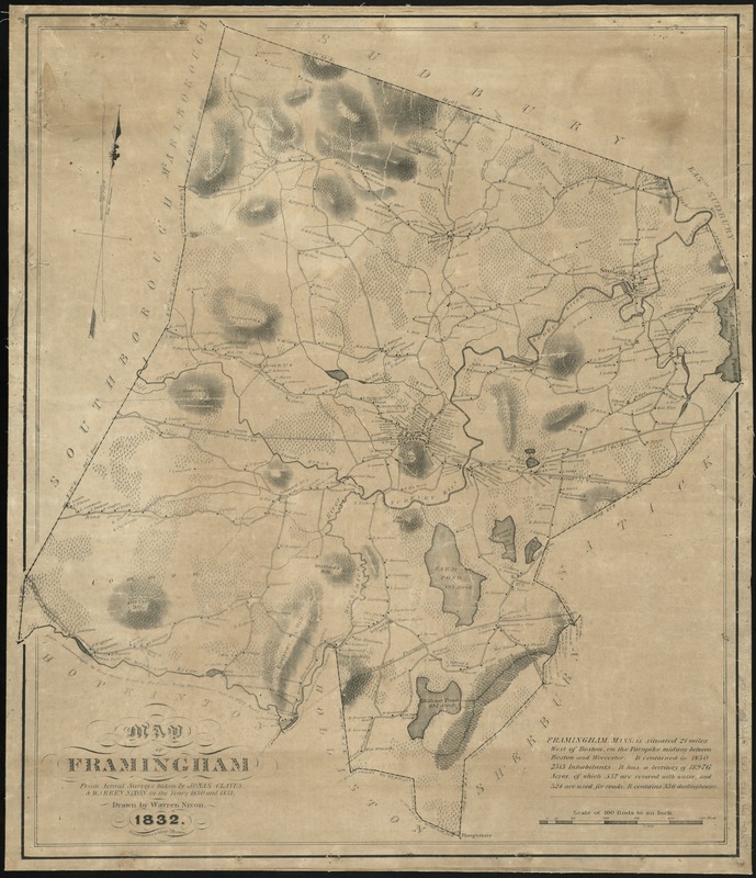
Map of Framingham : from actual surveys taken by Jonas Clayes & Warren Nixon in the years 1830 and 1831
Item Information
- Title:
- Map of Framingham : from actual surveys taken by Jonas Clayes & Warren Nixon in the years 1830 and 1831
- Creator:
- Nixon, Warren.
- Name on Item:
-
drawn by Warren Nixon.
- Date:
-
1832
- Format:
-
Maps/Atlases
- Location:
-
Boston Public Library
Norman B. Leventhal Map Center - Collection (local):
-
Norman B. Leventhal Map Center Collection
- Series:
- Caldwell Collection of Massachusetts Town Plans
- Subjects:
-
Real property--Massachusetts--Framingham--Maps
Framingham (Mass.)--Maps
- Places:
-
Middlesex (county)Framingham
- Extent:
- 1 map ; 65 x 55 cm.
- Terms of Use:
-
No known copyright restrictions.
No known restrictions on use.
- Publisher:
-
Boston :
Pendleton's Lithogy
- Scale:
-
Scale [1:19,800]. 100 rods to an in.
- Language:
-
English
- Notes:
-
Relief shown by shading and hachures.
Names of property owners are indicated.
- Identifier:
-
06_01_009635
- Call #:
-
G3764.F7 1832 .C53
- Barcode:
-
39999065663823