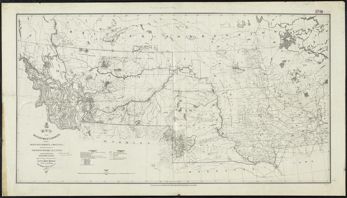
Map of the Department of Dakota including Minnesota, Dakota and Montana
Item Information
- Title:
- Map of the Department of Dakota including Minnesota, Dakota and Montana
- Creator:
- Rakowicz, E. H.
- Name on Item:
-
prepared by authority of Brigadier General A.H. Terry in the Engineer Office, Department of Dakota ; compiled and drawn under the direction of Lieut. John Biddle, Corps of Engineers by E.H. Rakowicz.
- Date:
-
1886
- Format:
-
Maps/Atlases
- Location:
-
Boston Public Library
Norman B. Leventhal Map Center - Collection (local):
-
Norman B. Leventhal Map Center Collection
- Subjects:
-
United States. Army. Dept. of Dakota--Maps
Minnesota--Maps
Montana--Maps
South Dakota--Maps
North Dakota--Maps
Northwestern States--Maps
- Places:
-
North Dakota
South Dakota
Montana
Minnesota
Great Plains (area)
- Extent:
- 1 map ; 65 x 122 cm.
- Terms of Use:
-
No known copyright restrictions.
No known restrictions on use.
- Publisher:
-
[Washington, D.C.] :
Office of the Chief of Engineers
- Scale:
-
Scale 1:1,500,000
- Language:
-
English
- Notes:
-
Shows military posts and reservations, indian reservations, telegraph lines, wagon roads, trails, and boundaries.
Relief shown by hachures.
- Identifier:
-
06_01_009271
- Call #:
-
G4125 1886 .R35
- Barcode:
-
39999065660035