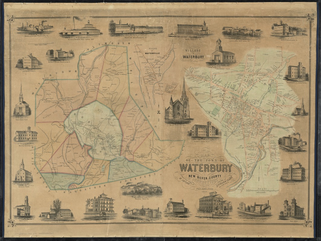
Map of the town of Waterbury, New Haven County, Connecticut
Item Information
- Title:
- Map of the town of Waterbury, New Haven County, Connecticut
- Creator:
- Irvine, H.
- Name on Item:
-
from actual survey by H. Irvine.
- Date:
-
1852
- Format:
-
Maps/Atlases
- Location:
-
Boston Public Library
Norman B. Leventhal Map Center - Collection (local):
-
Norman B. Leventhal Map Center Collection
- Subjects:
-
Waterbury (Conn.)--Maps
- Places:
-
New Haven (county)Waterbury
- Extent:
- 2 maps on 1 sheet : col. ; 89 x 120 cm.
- Terms of Use:
-
No known copyright restrictions.
No known restrictions on use.
- Publisher:
-
Philadelphia :
Richard Clark
- Scale:
-
Scale [ca. 1:3,330]
Scale [1:15,840]. 4 in. to the mi.
- Language:
-
English
- Table of Contents:
-
[Waterbury and vicinity]
Village of Waterbury.
- Notes:
-
Border includes illustrations of signficant buildings and establishments in Waterbury.
- Identifier:
-
06_01_009207
- Call #:
-
G3784.W3 1852 .I78
- Barcode:
-
39999065660662