Dinsmore's new railroad map of the United States and the Canadas, showing all the railroads completed and in progress, carefully compiled from official sources, for Dinsmore's railroad guide
Item Information
- Title:
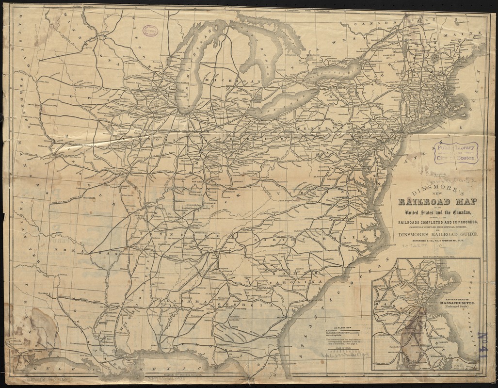
- Dinsmore's new railroad map of the United States and the Canadas, showing all the railroads completed and in progress, carefully compiled from official sources, for Dinsmore's railroad guide
- Date:
-
[1860]
- Format:
-
Maps/Atlases
- Location:
-
Boston Public Library
Norman B. Leventhal Map Center - Collection (local):
-
Norman B. Leventhal Map Center Collection
- Subjects:
-
Railroads--Canada--Maps
Railroads--United States--Maps
Railroads--Massachusetts--Maps
Canada--Maps
United States--Maps
- Places:
-
Massachusetts
Canada
- Extent:
- 1 map ; 49 x 62 cm.
- Terms of Use:
-
No known copyright restrictions.
No known restrictions on use.
- Publisher:
-
New York :
Dinsmore & Co.
- Scale:
-
Scale [ca. 1:4,000,000]
- Language:
-
English
- Notes:
-
Railroad situation at Cedar Rapids and Ottumwa, Iowa, and St. Joseph, Missouri, not earlier than September 1859; at Ottumwa, not later than July 1, 1865. Cf. R.E. Riegel. Story of the Western railroads; R.C. Overton, History of the Burlington lines. Cotton gin advertised on verso of map patented June and September 1860.
Prime meridians: Greenwich and Washington.
Relief shown by hachures.
"The numbers upon the map refer to corresponding numbers in the Index to Railroads" in the Guide.
Inset: Eastern part of Massachusetts (enlarged scale).
Fisk & Russell, engravers.
Advertisements on verso.
- Notes (date):
-
This date is inferred.
- Identifier:
-
06_01_009201
- Call #:
-
G3701.P3 1860 .D56
- Barcode:
-
39999065660928


