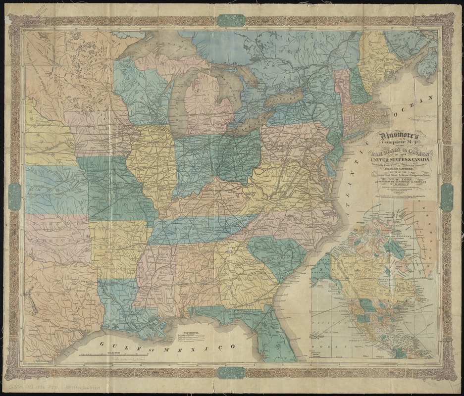
Dinsmore's complete map of the railroads & canals in the United States & Canada
Item Information
- Title:
- Dinsmore's complete map of the railroads & canals in the United States & Canada
- Title (alt.):
-
Complete map of the railroads & canals in the United States & Canada
- Creator:
- Fisher, Richard Swainson.
- Name on Item:
-
carefully compiled from authentic sources by Richard S. Fisher ; engraved ... by Schonberg & Co.
- Date:
-
1856
- Format:
-
Maps/Atlases
- Location:
-
Boston Public Library
Norman B. Leventhal Map Center - Collection (local):
-
Norman B. Leventhal Map Center Collection
- Subjects:
-
Railroads--United States--Maps
Railroads--Canada--Maps
Canals--United States--Maps
Canals--Canada--Maps
United States--Maps
- Places:
-
United States
Canada
- Extent:
- 1 map : col. ; 58 x 71 cm.
- Terms of Use:
-
No known copyright restrictions.
No known restrictions on use.
- Publisher:
-
New York :
Dinsmore & Co.
- Scale:
-
Scale [ca. 1:4,000,000]
- Language:
-
English
- Notes:
-
Map of the eastern half of the United States and part of Canada showing drainage, state boundaries, and proposed, projected, and operating railroads.
Relief shown by hachures.
Prime meridians: New York and Greenwich.
Inset: [North America]
- Identifier:
-
06_01_009181
- Call #:
-
G3701.P3 1856 .F571
- Barcode:
-
39999065660720
- LCCN:
-
2003627014


