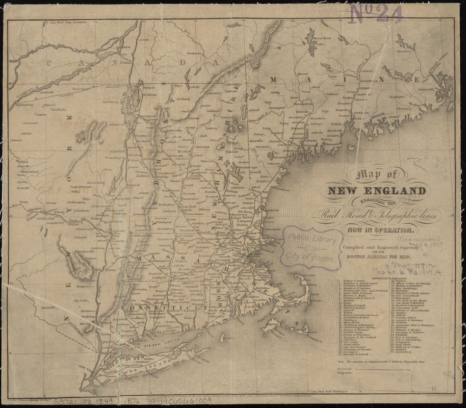
Map of New England exhibiting the rail road & telegraphic lines now in operation
Item Information
- Title:
- Map of New England exhibiting the rail road & telegraphic lines now in operation
- Creator:
- Brown & Hastings
- Name on Item:
-
drawn by Brown & Hastings, civl. engrs. ; engraved by G.W. Boynton.
- Date:
-
1849
- Format:
-
Maps/Atlases
- Location:
-
Boston Public Library
Norman B. Leventhal Map Center - Collection (local):
-
Norman B. Leventhal Map Center Collection
- Subjects:
-
Railroads--New England--Maps
Railroads--New York (State)--Maps
Telegraph lines--New England--Maps
Telegraph lines--New York (State)--Maps
New England--Maps
New York (State)--Maps
- Places:
-
New England (area)
New York
- Extent:
- 1 map ; 24 x 28 cm.
- Terms of Use:
-
No known copyright restrictions.
No known restrictions on use.
- Publisher:
-
[Boston] :
Coolidge & Wiley
- Scale:
-
Scale [ca. 1:2,625,000]
- Language:
-
English
- Notes:
-
Prime meridians: Washington and Greenwich.
Relief shown by hachures.
"Compiled and engraved expressly for the Boston Almanac for 1850."
"Entered according to Act of Congress in the year 1849 by Coolidge & Wiley in the Clerks Office of the District Court of the District of Massachusetts."
Includes "References to rail roads."
- Identifier:
-
06_01_009157
- Call #:
-
G3721.P3 1849 .B76
- Barcode:
-
39999065661009


