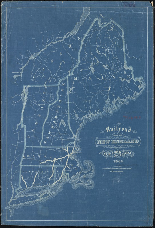
Railroad map of New England, with adjacent portions of New York & Canada
Item Information
- Title:
- Railroad map of New England, with adjacent portions of New York & Canada
- Creator:
- Pearson, J. W.
- Date:
-
1840
- Format:
-
Maps/Atlases
- Location:
-
Boston Public Library
Norman B. Leventhal Map Center - Collection (local):
-
Norman B. Leventhal Map Center Collection
- Subjects:
-
Railroads--New England--Maps
New England--Maps
- Places:
-
New England (area)
- Extent:
- 1 map ; 59 x 40 cm.
- Terms of Use:
-
No known copyright restrictions.
No known restrictions on use.
- Publisher:
-
S.l :
[s.n.]
- Scale:
-
Scale [ca. 1:1,500,000]
- Language:
-
English
- Notes:
-
Blueprint.
- Identifier:
-
06_01_009132
- Call #:
-
G3721.P3 1840 .P43x
- Barcode:
-
39999065659078


