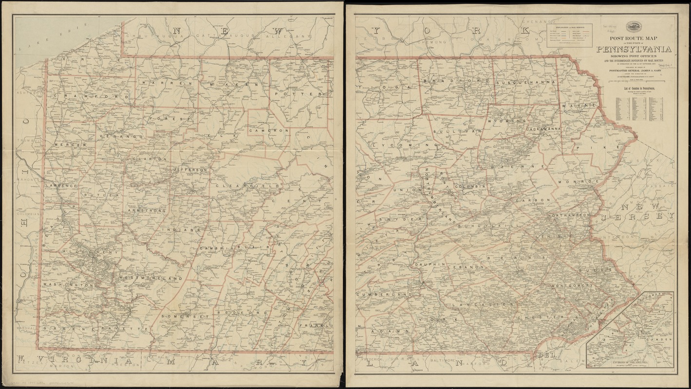
Post route map of the state of Pennsylvania showing post offices and the intermediate distances on mail routes in operation on the 1st. of September, 1897
Item Information
- Title:
- Post route map of the state of Pennsylvania showing post offices and the intermediate distances on mail routes in operation on the 1st. of September, 1897
- Creator:
- United States. Post Office Dept
- Name on Item:
-
published by order of Postmaster General James A. Gary under the direction of A. von Haake, topographer, P.O. Dept.
- Date:
-
1897
- Format:
-
Maps/Atlases
- Location:
-
Boston Public Library
Norman B. Leventhal Map Center - Collection (local):
-
Norman B. Leventhal Map Center Collection
- Subjects:
-
Counties--Pennsylvania--Maps
Postal service--Pennsylvania--Maps
Railroads--Pennsylvania--Maps
Pennsylvania--Maps
- Places:
-
Pennsylvania
- Extent:
- 1 map on 2 sheets : col. ; 97 x 174 cm., on sheets 104 x 94 cm.
- Terms of Use:
-
No known copyright restrictions.
No known restrictions on use.
- Publisher:
-
[Washington] :
Post Office Dept.
- Scale:
-
Scale [ca. 1:321,000]
- Language:
-
English
- Notes:
-
Also shows railroads and counties.
Inset: Environs of Philadelphia.
Includes list of counties showing relative position.
- Identifier:
-
06_01_009084
- Call #:
-
G3821.P8 1897 .U55x
- Barcode:
-
39999065659698


