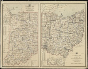
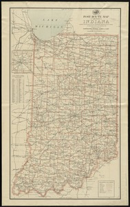
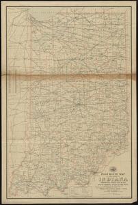
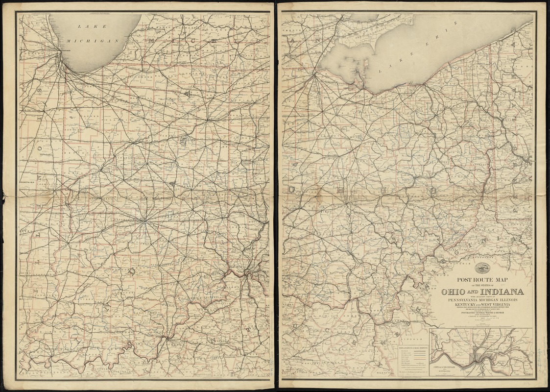
Post route map of the states of Ohio and Indiana with adjacent parts of Pennsylvania, Michigan, Illinois, Kentucky and West Virginia showing post offices, with the intermediate distances between them and mail routes in operation on 1st August 1883
Item Information
- Title:
- Post route map of the states of Ohio and Indiana with adjacent parts of Pennsylvania, Michigan, Illinois, Kentucky and West Virginia showing post offices, with the intermediate distances between them and mail routes in operation on 1st August 1883
- Creator:
- United States. Post Office Dept
- Name on Item:
-
published by order of Postmaster General Walter Q. Gresham under the direction of C. Roeser, Jr., Topographer, P.O. Dept.
- Date:
-
1883
- Format:
-
Maps/Atlases
- Location:
-
Boston Public Library
Norman B. Leventhal Map Center - Collection (local):
-
Norman B. Leventhal Map Center Collection
- Subjects:
-
Postal service--Indiana--Maps
Postal service--Ohio--Maps
- Places:
-
Indiana
Ohio
- Extent:
- 1 map on 2 sheets : col. ; 102 x 142 cm., on sheets 108 x 76 cm.
- Terms of Use:
-
No known copyright restrictions.
No known restrictions on use.
- Publisher:
-
Washington, D.C :
[The Dept.]
- Scale:
-
Scale [1:506,880]. Eight miles to the in.
- Language:
-
English
- Notes:
-
Also shows railroads and counties.
Prime meridian: Washington, D.C.
Inset: City of Cincinnati and environs.
"The first edition was issued in 1870."
"The service on this diagram brought up to date of Aug. 1 83."
- Identifier:
-
06_01_008927
- Call #:
-
G4081.P8 1883 .U55x
- Barcode:
-
39999065658666