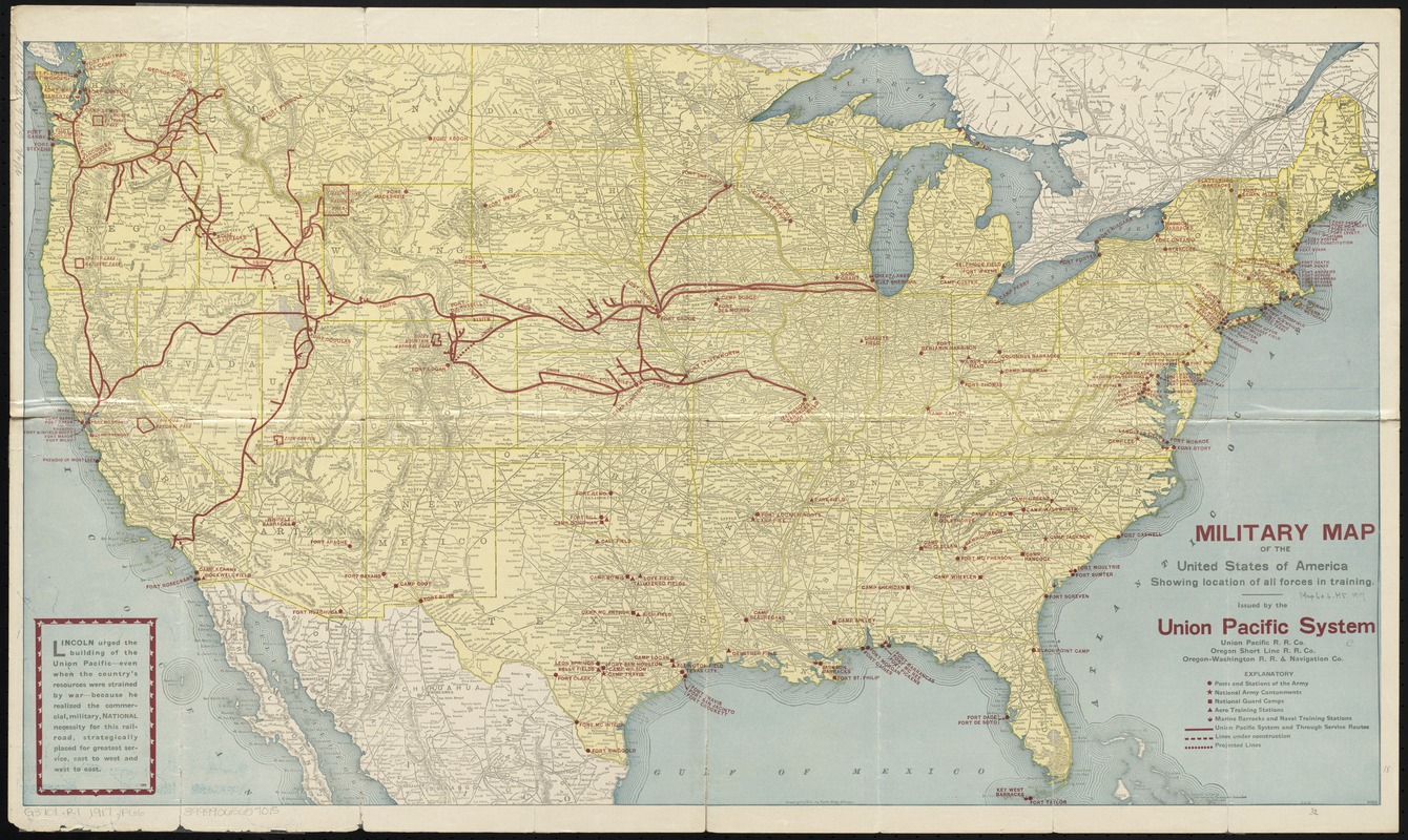
Military map of the United States of America showing location of all forces in training
Item Information
- Title:
- Military map of the United States of America showing location of all forces in training
- Panel title :
- Military map of the U.S.A. showing where our forces are training
- Name on Item:
-
issued by the Union Pacific System.
- Date:
-
1917
- Format:
-
Maps/Atlases
- Location:
-
Boston Public Library
Norman B. Leventhal Map Center - Collection (local):
-
Norman B. Leventhal Map Center Collection
- Subjects:
-
United States. Army
United States. Navy
United States. Marine Corps
Military training camps--United States--Maps
Military bases--United States--Maps
Air bases--United States--Maps
Navy-yards and naval stations--United States--Maps
World War, 1914-1918--United States--Maps
Railroads--United States--Maps
National parks and reserves--United States--Maps
United States--National Guard
United States--Maps
- Places:
-
- Extent:
- 1 map : col. ; 46 x 82 cm. folded to 26 x 11 cm.
- Terms of Use:
-
No known copyright restrictions.
No known restrictions on use.
- Publisher:
-
Chicago :
Poole Bros.
- Scale:
-
Scale [ca. 1:5,900,000]
- Language:
-
English
- Notes:
-
Relief shown by hachures.
Shows locations of military training bases, national parks, and Union Pacific railroad lines; state boundaries and major cities and towns.
"8-1-17."
"6095."
On verso: text; ill., photographs; lists of National Army cantonment camps, National Guard concentration camps, increment camps, reserve officers' training camps, aero training stations, posts and stations of the Army, Naval stations and Marine barracks.
- Identifier:
-
06_01_008894
- Call #:
-
G3701.R1 1917 .P66
- Barcode:
-
39999065657015


