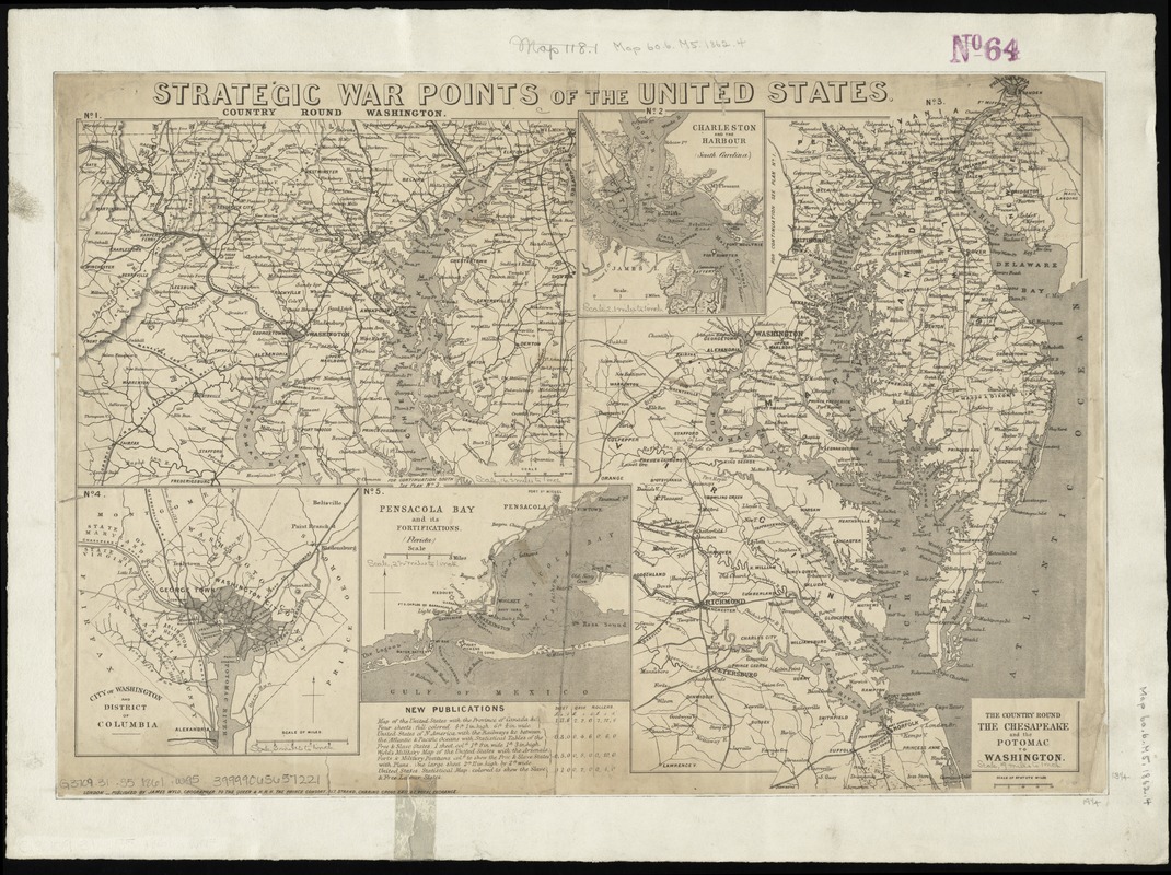
Strategic war points of the United States
Item Information
- Title:
- Strategic war points of the United States
- Creator:
- Wyld, James, 1812-1887
- Date:
-
[1861?]
- Format:
-
Maps/Atlases
- Location:
-
Boston Public Library
Norman B. Leventhal Map Center - Collection (local):
-
Norman B. Leventhal Map Center Collection
- Subjects:
-
Atlantic States--History--Civil War, 1861-1865--Maps
- Places:
-
Eastern Shore (area)
- Extent:
- 5 maps on 1 sheet ; sheet 34 x 52 cm.
- Terms of Use:
-
No known copyright restrictions.
No known restrictions on use.
- Publisher:
-
London :
James Wyld
- Scale:
-
Scales differ
- Language:
-
English
- Table of Contents:
-
No. 1. Country round Washington
No. 2. Charleston and the harbour (South Carolina)
No. 3. The country round the Chesapeake and the Potomac to Washington
No. 4. City of Washington and District of Columbia
No. 5. Pensacola Bay and its fortifictions (Florida).
- Notes:
-
List of "new publications" at the bottom of the sheet.
- Identifier:
-
06_01_008883
- Call #:
-
G3709.31.S5 1861 .W95
- Barcode:
-
39999065657221
- LCCN:
-
99447064


