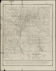
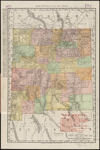
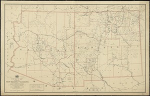
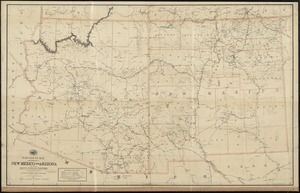
Territory of New Mexico
Item Information
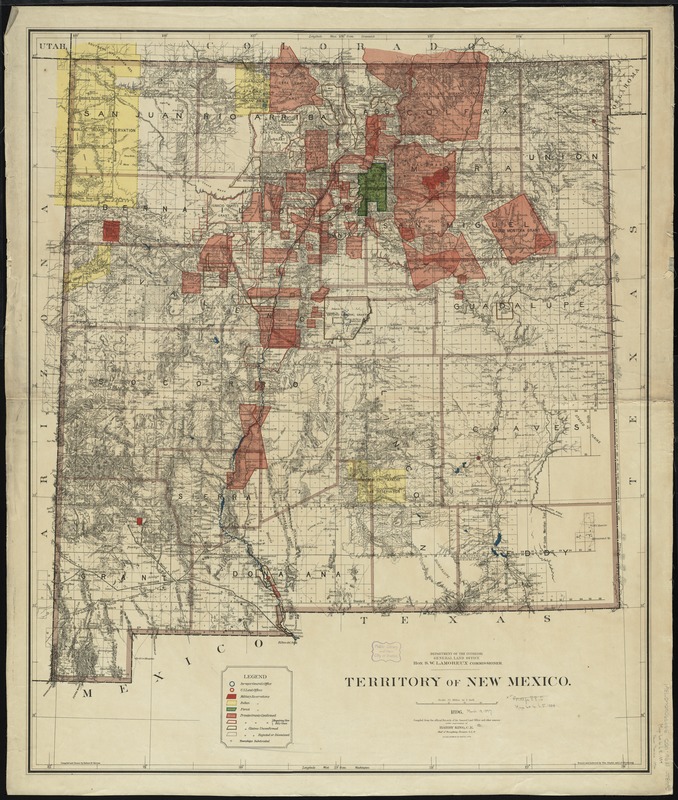
- Title:
- Territory of New Mexico
- Creator:
- United States. General Land Office
- Name on Item:
-
compiled from the official records of the General Land Office and other sources under supervision of Harry King, C.E. ; compiled and drawn by Robert H. Morton ; traced and lettered by Wm. Naylor and I.P. Berthrong.
- Date:
-
1896
- Format:
-
Maps/Atlases
- Location:
-
Boston Public Library
Norman B. Leventhal Map Center - Collection (local):
-
Norman B. Leventhal Map Center Collection
- Subjects:
-
Railroads--New Mexico--Maps
Indian reservations--New Mexico--Maps
Military reservations--New Mexico--Maps
Forest reserves--New Mexico--Maps
Land grants--New Mexico--Maps
Public lands--New Mexico--Maps
Roads--New Mexico--Maps
Mines and mineral resources--New Mexico--Maps
New Mexico--Maps
- Places:
-
New Mexico
- Extent:
- 1 map : col. ; 97 x 80 cm.
- Terms of Use:
-
No known copyright restrictions.
No known restrictions on use.
- Publisher:
-
[Washington, D.C.?] :
Dept. of the Interior, General Land Office
- Scale:
-
Scale [1:760,320]. 12 miles to 1 inch.
- Language:
-
English
- Notes:
-
Relief shown by hachures.
Shows township grid, railroads, Indian reservations, military reservations, forests, private land grants, and mining activity.
Prime meridians: Washington and Greenwich.
- Identifier:
-
06_01_008846
- Call #:
-
G4320 1896 .U55
- Barcode:
-
39999065657361