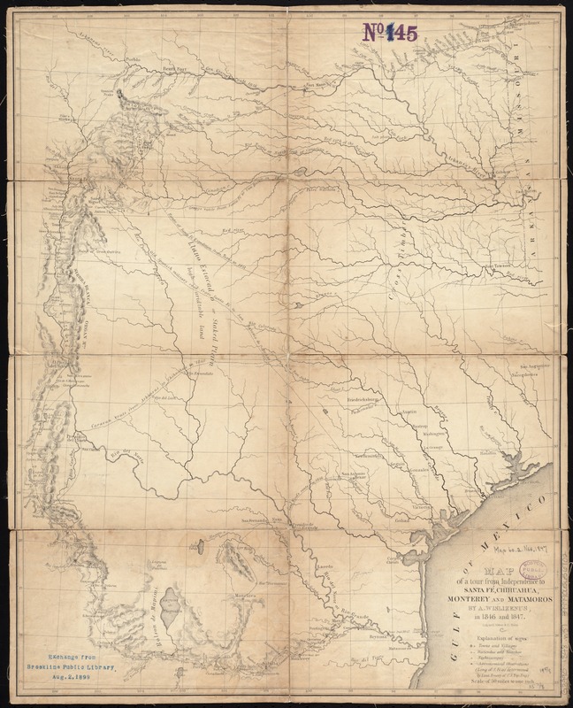
Map of a tour from Independence to Santa Fé, Chihuahua, Monterey and Matamoros
Item Information
- Title:
- Map of a tour from Independence to Santa Fé, Chihuahua, Monterey and Matamoros
- Creator:
- Wislizenus, F. A. (Frederick Adolph), 1810-1889
- Name on Item:
-
by A. Wislizenus, in 1846 and 1847 ; lith. by E. Weber & Co.
- Date:
-
[1848]
- Format:
-
Maps/Atlases
- Location:
-
Boston Public Library
Norman B. Leventhal Map Center - Collection (local):
-
Norman B. Leventhal Map Center Collection
- Subjects:
-
Texas--Maps
West (U.S.)--Maps
Mexican-American Border Region--Maps
- Places:
-
Western United States (area)
Texas
- Extent:
- 1 map ; 49 x 40 cm.
- Terms of Use:
-
No known copyright restrictions.
No known restrictions on use.
- Publisher:
-
Washington :
Tippin & Streeper
- Scale:
-
Scale [1:1:3,168,000]. 50 miles to one inch
- Language:
-
English
- Notes:
-
Covers Texas and parts of neighboring states and northern Mexico.
Relief shown by hachures.
Shows routes of Gen. Kearny, Gen. Gregg, and Gen. Wool, Spanish military roads, forts, and wagon roads.
From Wislizenus's Memoir of a tour to northern Mexico. Washington : Tippin & Streeper, 1848.
- Notes (date):
-
This date is inferred.
- Identifier:
-
06_01_008724
- Call #:
-
G3990 1848 .W57
- Barcode:
-
39999065656702