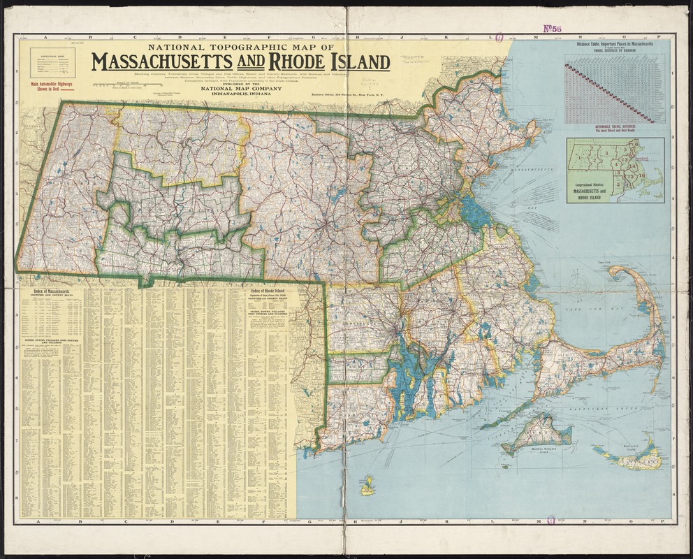
National topographic map of Massachusetts and Rhode Island : showing counties, townships, cities, villages and post offices ... according to the latest census
Item Information
- Title:
- National topographic map of Massachusetts and Rhode Island : showing counties, townships, cities, villages and post offices ... according to the latest census
- Creator:
- National Map Company
- Date:
-
[1916–1918]
- Format:
-
Maps/Atlases
- Location:
-
Boston Public Library
Norman B. Leventhal Map Center - Collection (local):
-
Norman B. Leventhal Map Center Collection
- Subjects:
-
Massachusetts--Maps
Rhode Island--Maps
- Places:
-
Massachusetts
Rhode Island
- Extent:
- 1 map : col. ; 89 x 123 cm.
- Terms of Use:
-
No known copyright restrictions.
No known restrictions on use.
- Publisher:
-
Indianapolis, Ind :
The Company
- Scale:
-
Scale 1:253,440. 4 miles to one inch
- Language:
-
English
- Notes:
-
Relief shown by hachures and spot heights.
Includes index, population figures, distance table, and map showing congressional districts.
- Notes (date):
-
This date is inferred.
- Identifier:
-
06_01_008704
- Call #:
-
G3760 1916 .N37x
- Barcode:
-
39999065656850


